
Helicopter makes emergency landing at Houma Airport
September 25, 2022
LPSO to Host 10th Annual Domestic Violence Awareness Vigil
September 26, 2022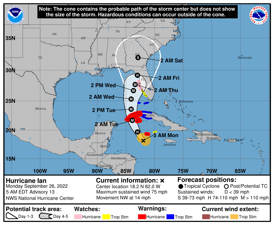
At 500 AM EDT (0900 UTC), the center of Hurricane Ian was located near latitude 18.2 North, longitude 82.0 West. Ian is moving toward the northwest near 14 mph (22 km/h). A turn toward the north-northwest is expected today followed by a northward motion on Tuesday with a slightly slower forward speed. A turn toward the north-northeast is forecast on Tuesday night or early Wednesday. On the forecast track, the center of Ian is expected to pass near or west of the Cayman Islands today, and near or over western Cuba tonight and early Tuesday. Ian will then emerge over the southeastern Gulf of Mexico on Tuesday, and pass west of the Florida Keys late Tuesday, and approach the west coast of Florida on Wednesday.
Maximum sustained winds have increased to near 75 mph (120 km/h) with higher gusts. Rapid strengthening is expected during the next day or so, and Ian is forecast to become a major hurricane tonight when it is near western Cuba.

Hurricane-force winds extend outward up to 15 miles (30 km) from the center and tropical-storm-force winds extend outward up to 90 miles (150 km).
The latest minimum central pressure estimated from Air Force Reserve reconnaissance aircraft data is 983 mb (29.03 inches).

