Louisiana State Police Cadet Class 101 Graduates 23 New Troopers
November 6, 2022
LHSAA releases High School Football Playoff Brackets
November 6, 2022
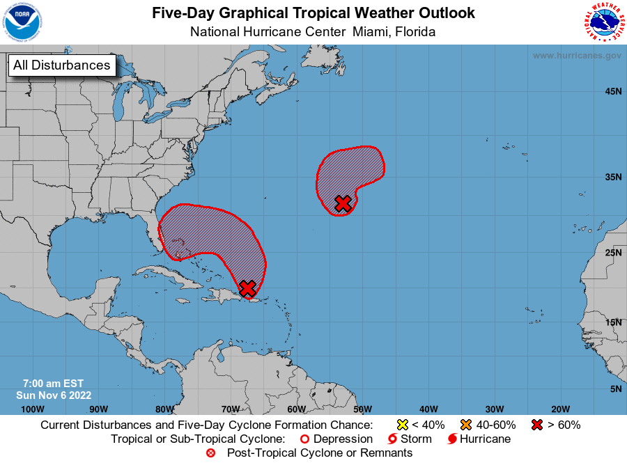
While it is no threat to Louisiana at this time, Invest 98L is worth watching as it is likely to develop into a named system later in the week as it nears the Florida coast. The other system looks to also form, but head away from the United States.
From the NHC:
An area of low pressure is developing about 100 miles north of Puerto Rico and is producing a large area of disorganized showers and thunderstorms. This system is forecast to move northward or northwestward further into the southwestern Atlantic today and environmental conditions appear generally conducive for additional development.

A subtropical or tropical depression is likely to form early this week while the system turns westward or west-southwestward over the southwestern Atlantic. Regardless of development, there is an increasing risk of coastal flooding, gale-force winds, heavy rainfall, rough surf, and beach erosion along much of the southeastern United States coast, the Florida east coast, and portions of the central and northwestern Bahamas during the early to middle part of this week. Interests in those areas should continue to monitor the progress of this system.
* Formation chance through 48 hours…high…70 percent.
* Formation chance through 5 days…high…90 percent.