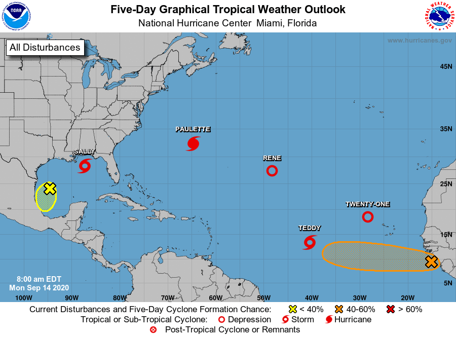
Elsewhere in the Atlantic: Five tropical cyclones ties record from 1971
September 14, 2020
Sheriff Soignet provides morning report on TS Sally for Terrebonne Parish
September 14, 2020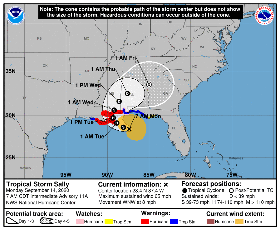
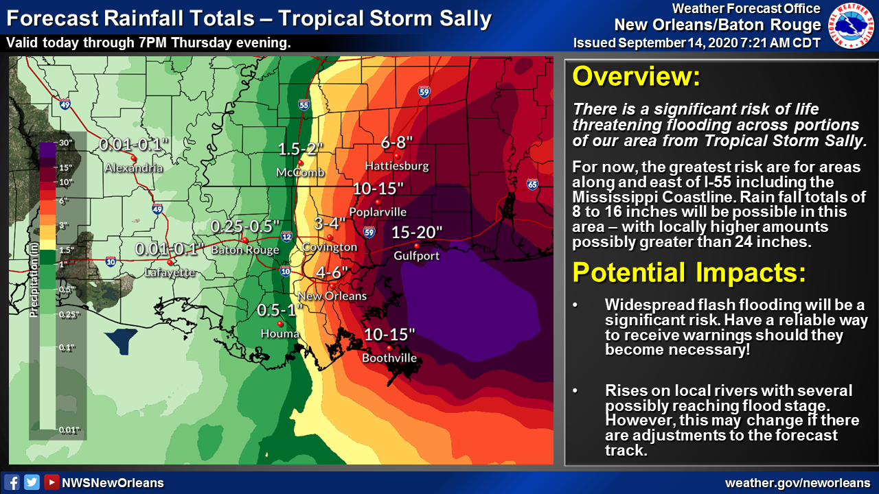
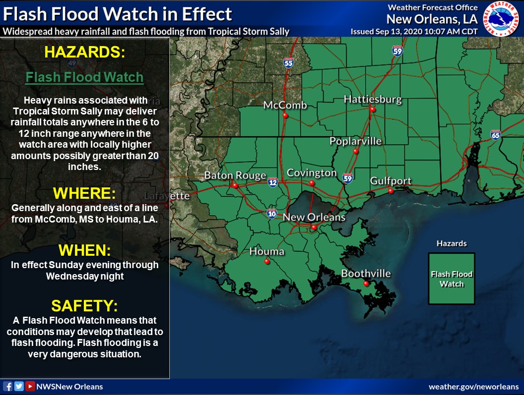
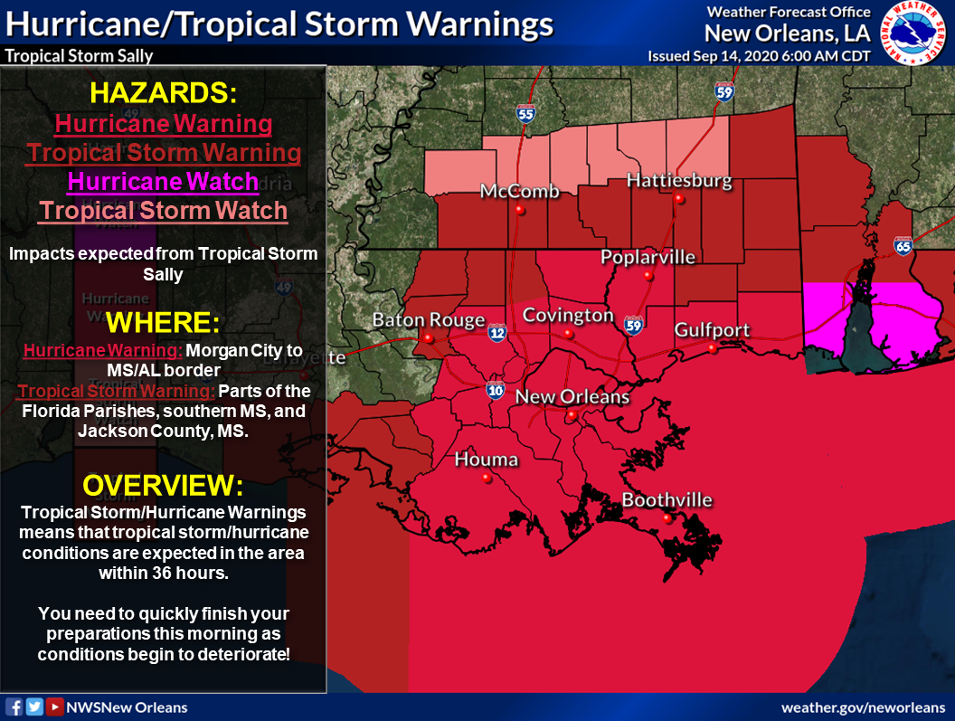
Still no major changes with the 7am update, with landfall still forecast for the Louisiana/Mississippi border. The slow moving storm is in no hurry, but still forecast to become a category 1 hurricane by landfall. Scattered showers are in the forecast for our area today. Right now, our total expected rainfall for the storm is between 2-3 inches. We remain under a hurricane warning for both parishes.

At 7 a.m. CDT, the center of Tropical Storm Sally was located about 115 miles (185 km) east-southeast of the mouth of the Mississippi River. Sally is moving toward the west-northwest near 8 mph (13 km/h). This general motion is expected today, followed by a decrease in forward speed and a turn to the northwest tonight and a northward turn sometime on Tuesday. On the forecast track, the center of Sally will move over the north-central Gulf of Mexico today, approach southeastern Louisiana this afternoon, and make landfall in the hurricane warning area on Tuesday. Afterward, Sally is expected to move slowly north-northeastward near the northern Gulf Coast through Wednesday.
Maximum sustained winds have increased to near 65 mph (100 km/h) with higher gusts. Tropical-storm-force winds extend outward up to 125 miles (205 km) from the center. NOAA buoy 42039, located about 130 miles (215 km) south-southeast of Pensacola, Florida, recently reported peak
sustained winds of 49 mph (79 km/h) and a gust to 58 mph (94 km/h). Strengthening is expected over the next day or so, and Sally is forecast to become a hurricane by tonight, with additional strengthening possible before the center crosses the northern Gulf Coast.

