
Mandatory evacuation order to stay in place for parts of Lafourche Parish
August 25, 2020
Terrebonne Solid Waste adjusting Garbage Pick-up Schedules
August 25, 2020
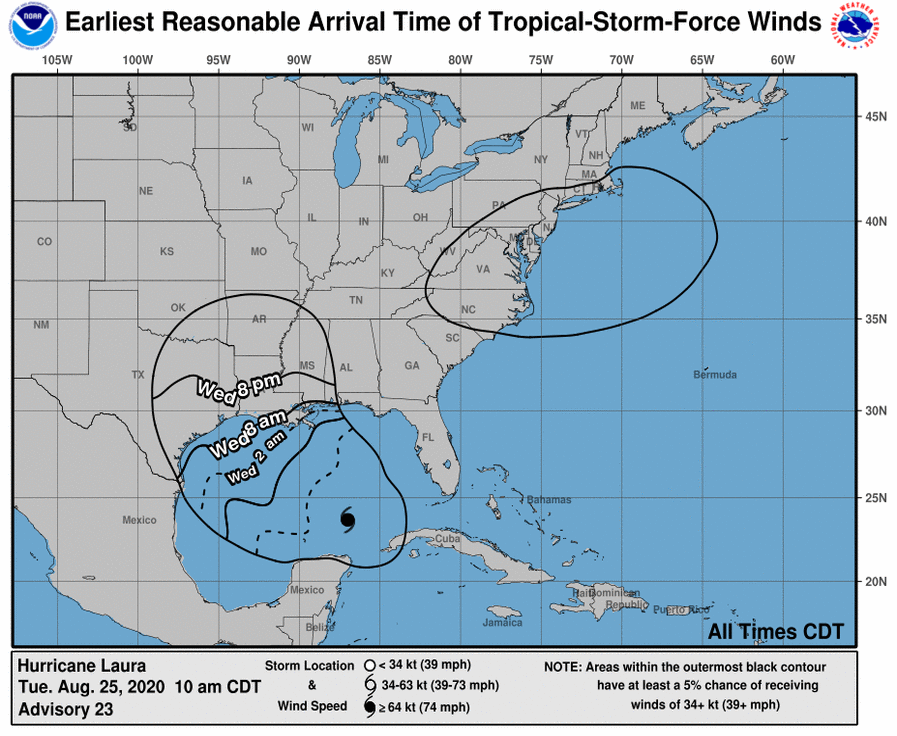
Hurricane conditions are expected in the hurricane warning area Wednesday night and Thursday. Tropical Storm conditions are expected to reach the coast in the hurricane warning area late Wednesday or Wednesday night, and are expected in the tropical storm warning area Wednesday night and Thursday. In our area, the greatest concern is the anticipated storm surge. The area from Morgan City LA to Mouth of the Mississippi River is forecast to experience a storm surge of 4-6 ft.
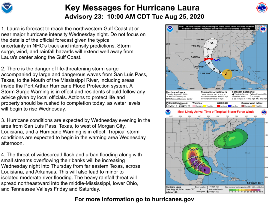
At 1 p.m. CDT, the center of Hurricane Laura was located about 525 miles (845 km) southeast of Lake Charles, La. It’s moving toward the west-northwest near 16 mph (26 km/h). On the forecast track, the center of Laura will move across the southeastern Gulf of Mexico today, move over the central and northwestern Gulf of Mexico tonight & Wednesday, approach the Upper Texas and Southwest Louisiana coasts on Wednesday night, and move inland near those area on Thursday.
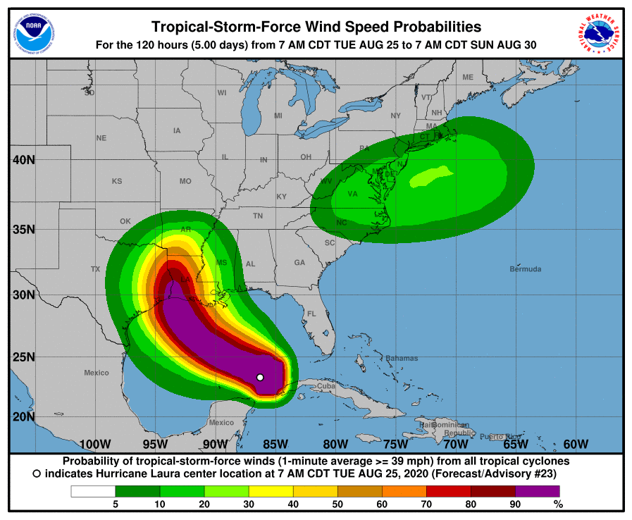
Maximum sustained winds are near 75 mph (120 km/h) with higher gusts. Hurricane-force winds extend outward up to 45 miles (75 km) from the center and tropical-storm-force winds extend outward up to 175 miles (280 km). Significant strengthening is forecast during the next 36 hours, and Laura is expected to be a major hurricane at landfall.

The combination of a dangerous storm surge and the tide will cause normally dry areas near the coast to be flooded by rising waters moving inland from the shoreline. The water could reach the following heights above ground somewhere in the indicated areas if the peak surge occurs at the time of high tide…
– Sea Rim State Park TX to Intracoastal City LA including Sabine Lake and Calcasieu Lake…9-13 ft
– Intracoastal City to Morgan City including Vermilion Bay…7-11 ft
– Port Bolivar TX to Sea Rim State Park…6-9 ft
– Morgan City LA to Mouth of the Mississippi River…4-6 ft
– San Luis Pass TX to Port Bolivar…3-5 ft
– Galveston Bay…3-5 ft
– Freeport TX to San Luis Pass…2-4 ft
– Mouth of the Mississippi River to Ocean Springs MS incl. Lake Borgne…3-5 ft
– Lake Pontchartrain and Lake Maurepas…2-4 ft
From Wednesday night into Saturday, Laura is expected to produce rainfall of 4 to 8 inches, with isolated maximum amounts of 12 inches across portions of the west-central U.S. Gulf Coast from western Louisiana into east Texas, and northward into portions of the lower to middle Mississippi Valley, lower Ohio Valley, and Tennessee Valley. This rainfall will cause widespread flash and urban flooding, small streams to overflow their banks, and minor to isolated moderate river flooding.

