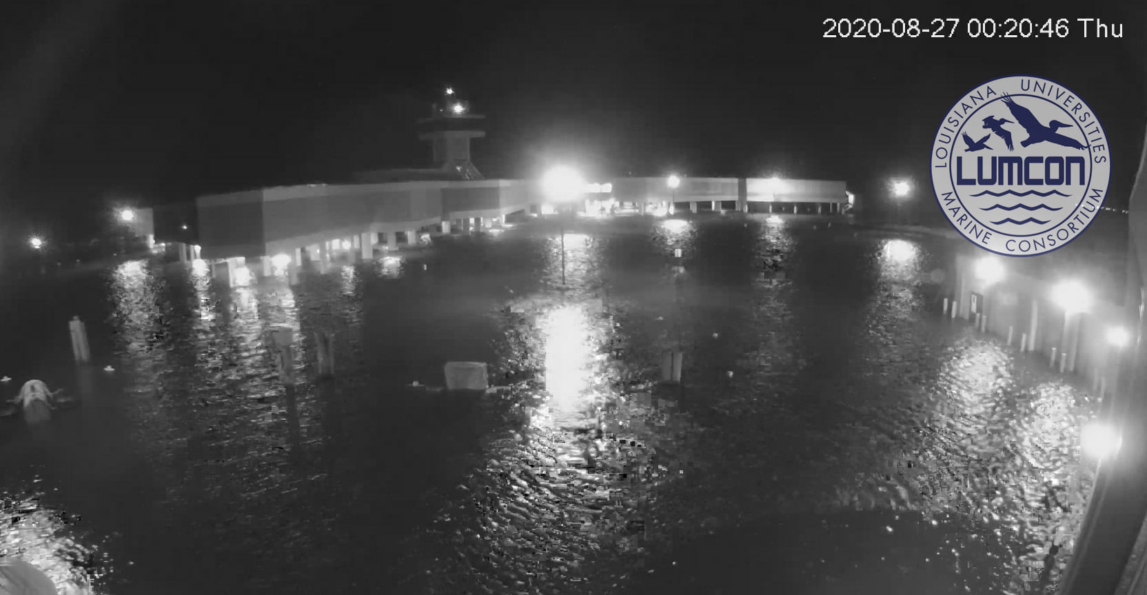
Water rising quickly at LUMCON
August 27, 2020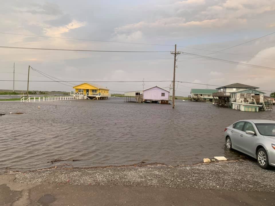
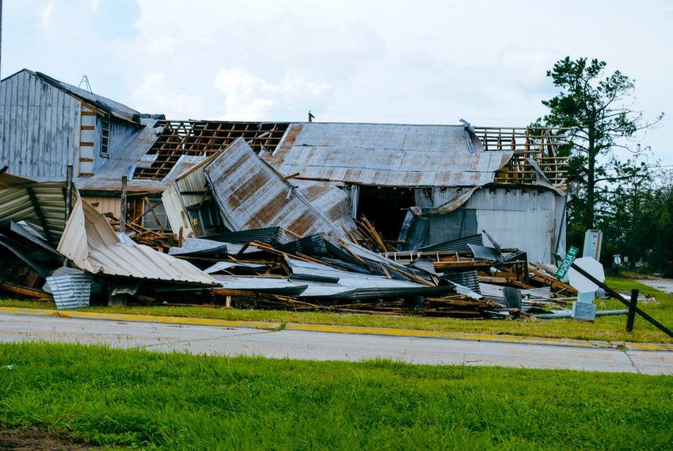
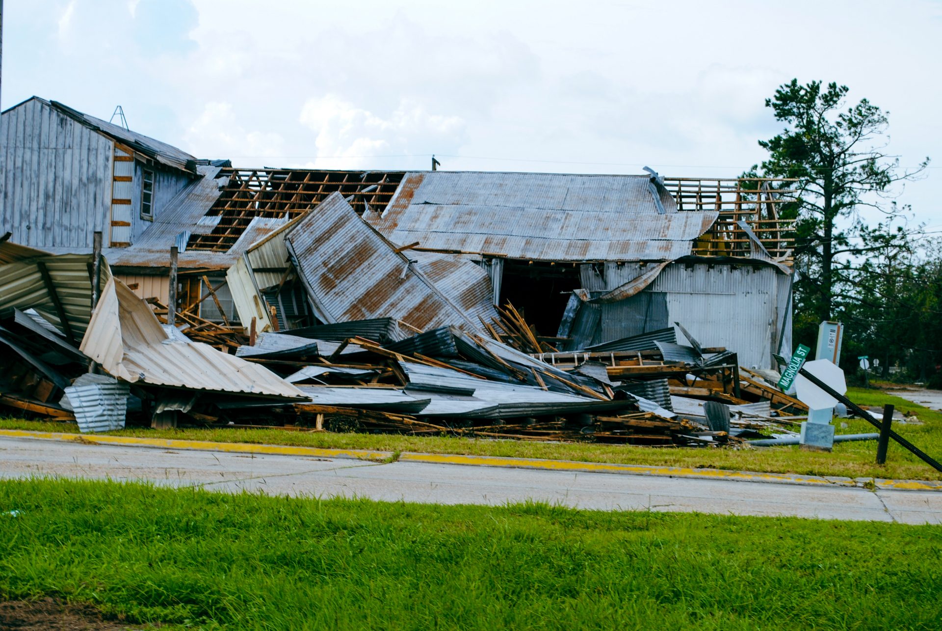
PHOTOS: Local images of water rising in Terrebonne and Lafourche
August 27, 2020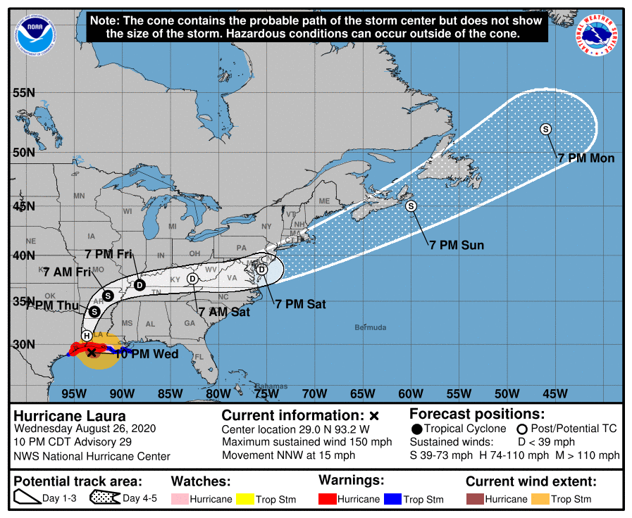
This morning, Laura is about 20 miles north of Fort Polk, Louisiana, traveling north-eastward, continuing to leave a path of destruction across the state. Winds are still near 100 mph, making this a category 2 storm. Rain bands are still sweeping across the state. Serious storm surge is still pushing on-shore along the coast.
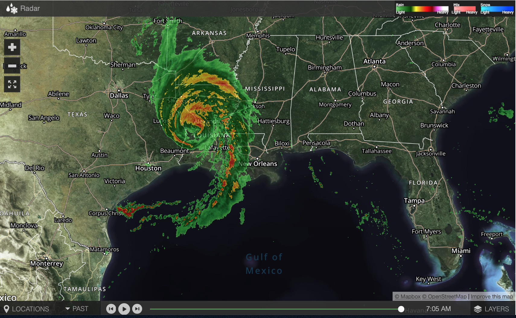
At 700 AM CDT (1200 UTC), the center of Hurricane Laura was located near latitude 31.2 North, longitude 93.3 West. Laura is moving toward the north near 15 mph (24 km/h) and this motion should
continue through the day. A northeastward to east-northeastward motion is expected tonight and Friday. On the forecast track, Laura will move northward across western and northern Louisiana
through this afternoon. The center of Laura is forecast to move over Arkansas tonight, the mid-Mississippi Valley on Friday, and the mid-Atlantic states on Saturday.

Maximum sustained winds are near 100 mph (160 km/h) with higher gusts. Rapid weakening is forecast, and Laura is expected to become a tropical storm later today.
Hurricane-force winds extend outward up to 60 miles (95 km) from the center and tropical-storm-force winds extend outward up to 175 miles (280 km). An observing site in Alexandria, Louisiana,
recently reported a wind gust to 74 mph (119 km/h). estimated minimum central pressure is 970 mb (28.64 inches).
