
Elizabeth Bergeron
June 27, 2018
New Orleans man charged with attempted murder in Thibodaux incident
June 27, 2018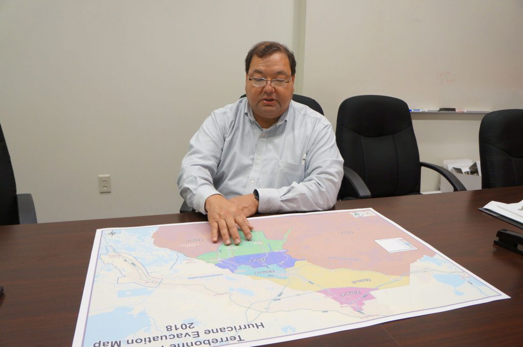
Parish President Gordon Dove and the Terrebonne Parish Office of Homeland Security and Emergency Preparedness (TOHSEP) expanded the hurricane evacuation from two to six evacuation zones.
The “substantial” completion of the Morganza to the Gulf levee system led to the creation of the new Terrebonne Parish Hurricane Evacuation Map.
“So now that we have the demarcation of the Morganza to the Gulf levee system, and also internal levees that the parish are responsible for and have upgraded, we’re now able to divide the parish into more zones,” Director of TOHSEP Earl Eues said.

TOHSEP monitors tropical systems at about five days before the possibility of storm conditions hitting land, usually before a storm reaches the Gulf of Mexico. Once a tropical system enters the Gulf, the department starts planning and preparing for the storm, carrying out all of the necessary preliminary functions.
Depending on the severity of a storm and the information they receive from the National Hurricane Center and the National Weather Service, TOHSEP, along with the Terrebonne Parish President, Sheriff’s Office and School Board (depending on if the school year started), make a decision on which, if not all, of the zones they will announce evacuations for. In the event of a major hurricane (Category 3-5), the office would call for a complete evacuation of the parish (zones 1-6). During the possibility of minor hurricanes (Category 1-2) TOHSEP uses the zone process, based on how the storm surge will affect different zones.
Storm advisories are typically issued for specific areas within 48 hours of possible storm conditions for a hurricane or tropical storm watch. A tropical storm or hurricane warning is advised usually within 36 hours of tropical storm or hurricane conditions.
Although the levee system has improved, TOHSEP still urges people to evacuate when advised by the parish.
“We have a great levee system. The levee district [Terrebonne Levee and Conservation District] and the parish have worked very hard to try to protect the residents as much as possible from storm surge, but residents need to remember that these levees were built to protect property, not lives,” Eues said.
Terrebonne Parish residents will be able to type in their address in the G.I.S Mapping System on the Terrebonne Parish Consolidated Government’s website, http://www.tpcg.org/, to find out what zone they live inside.

An extensive hurricane preparedness guide, flooding and hurricane info, evacuation notices and more information can be found on TOHSEP’s website, http://www.tohsep.com/, and their Twitter and Facebook pages.
