Tuesday, June 7
June 7, 2011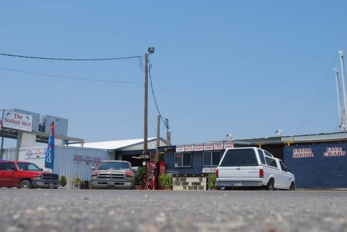
Economic life of LA1 businesses in limbo
June 9, 2011Manmade preparations during the past month, along with drought conditions have been credited with averting what was at one time thought to be certain backwater flooding from the Atchafalaya River in St. Mary and Terrebonne parishes.

Seventeen floodgates on the Morganza Spillway had been opened to ease flooding on the Mississippi River, and forecasters at the time expected the Atchafalaya Basin to fill to a degree not seen in 38 years.

With hurricane season into its first week and waterways yet to completely stabilize to their normal levels, concern of tropical storm hits in the coming weeks could mean all efforts to fight backwater flooding from inland would be lost to powerful influences in the south.
While it is always good to be on alert, National Weather Service hydrologist Jeff Graschel said that for the immediate future, concerns of backwater flooding because of offshore weather patterns do not appear to be warranted. But that does not mean it could not happen.

“If you look at it historically, at least with early parts of the season, you typically have weaker systems,” Graschel said. “For the most part we’ve only really had a handful of storms occurring at that time and only one of them being of a hurricane category. Most of them have been in the tropical storm category. Even with tropical storms, you still have wind effects and surge effects, but less than what we get with stronger storms in the August and September.”
Tides in southern Louisiana are generally wind driven, and a strong wind driving toward land over the course of several days could eventually cause salty backwater flooding in bayous and other tributaries. That backwater flooding as storms arrive onshore is frequently seen in towns such as Cocodrie, according to Louisiana Universities Marine Consortium professor Paul Sammarco.
“If there is a hurricane, the storm surge will come in a very short period of time,” Sammarco said. “That’s what happened with Hurricane Andrew. [We had] 9.5 feet in 45 minutes. The longer wind blows from the south, the more water pushes north. It takes a relatively short time for the water to go inland, but it takes a long time for it to ebb back towards the Gulf.”
Graschel said that storms like the Category 5 Hurricane Andrew in August 1992, and Category 2 Hurricane Ida in November 2009, each had strong enough winds to cause backwater flooding. He also noted that they hit later in the season, but still caused damage.
“Any sort of additional rainfall, any sort of additional wind out of the south would play a role in causing areas to have more aggravation and flooding problems than areas that already have high water,” Graschel said. “You can never say never, but from a historical perspective, there has not been anything [this time of year that would impact current high water coming from rivers and other outlets]. But that’s not to say something couldn’t happen.”
“When you add flooding from the north, a push of wind and water from the south will hold up the normal flow of that water and cause a damming effect,” Sammarco said.
As hurricanes make landfall from the south, a squall can circle around from the north and cause increased rain and flooding.
If the Atchafalaya River system would have to come up with any sort of surge, it would be difficult to guess on any areas.
“Rainfall alone could be a factor,” Graschel said. “You have a lot of areas that are in backwater or not able to drain out very well because the water is at a very high level. So any additional rainfall in these locations could cause more pounding or flooding problems because there is not anywhere for that water to drain.
“We looked at 1973 and times that we had comparable water in the system, but we didn’t have any tropical systems and hopefully that will be the case this time, too,” he continued.
“We haven’t had any amount of high water that we are now looking at with any [approaching] tropical system,” Sammarco said. “We have lower levels on the rivers typically when we have these storms come in and can see times when levels on the Mississippi River are seen all the way to Baton Rouge. I think we’re lucky that the Mississippi River flow that we are now experiencing is less than originally predicted, and that we are not facing the prospects of any major storms at this time.”

