
Sally Ann LeBouef Naquin
August 19, 2020
HPD: 16-year-old shot on South Van Avenue
August 19, 2020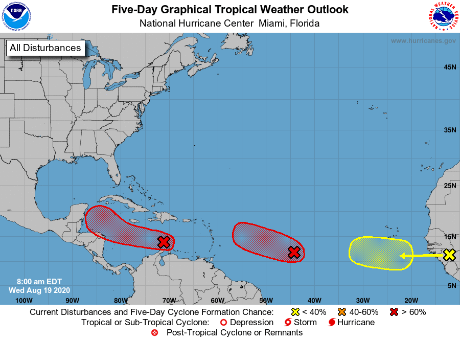
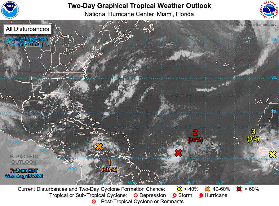
NHC is closely watching three areas over the Atlantic basin on this Wednesday morning. The first two have high chances of formation during the next 5 days. The newest system is showing a 20 percent chance over the next 5 days.

From the National Hurricane Center:
The first is a tropical wave located over the eastern Caribbean Sea, producing disorganized showers and thunderstorms, along with gusty winds in these thunderstorms. Some gradual development of this system is possible during the next day or so while it moves westward at about 15 to 20 mph across the central Caribbean Sea. After that time, the wave is forecast to move more slowly west-northwestward, and a tropical depression is likely to form late this week or this weekend when the system reaches the northwestern Caribbean Sea. It has a medium (40 percent) chance of formation during the next 48 hours and high (80 percent) chance during the next five days days.
The second is an elongated area of low pressure located a little more than 1000 miles east of the Windward Islands, continuing to produce a concentrated area of showers and thunderstorms mainly on the west side of the disturbance. Environmental conditions are conducive for further development, and a tropical depression is expected to form during the next day or two while the system moves generally west-northwestward at 15 to 20 mph across the central and western portions of the tropical Atlantic. It has a high (90 percent) chance of formation during the next 48 hours and five days.
The third is a large area of showers and thunderstorms located over Guinea and Sierra-Leone, Africa, associated with a vigorous tropical wave. Environmental conditions are expected to be marginally conducive for some development of this system while the wave enters the extreme eastern Atlantic on Friday. By early next week, however, conditions are forecast to become less favorable for tropical cyclone formation while it moves west-northwestward at 15 to 20 mph toward the central tropical Atlantic. It has a near zero chance of formation during the next 48 hours and low (20 percent) chance during the next five days.

