
Lafourche Entergy Update Sept. 13
September 13, 2021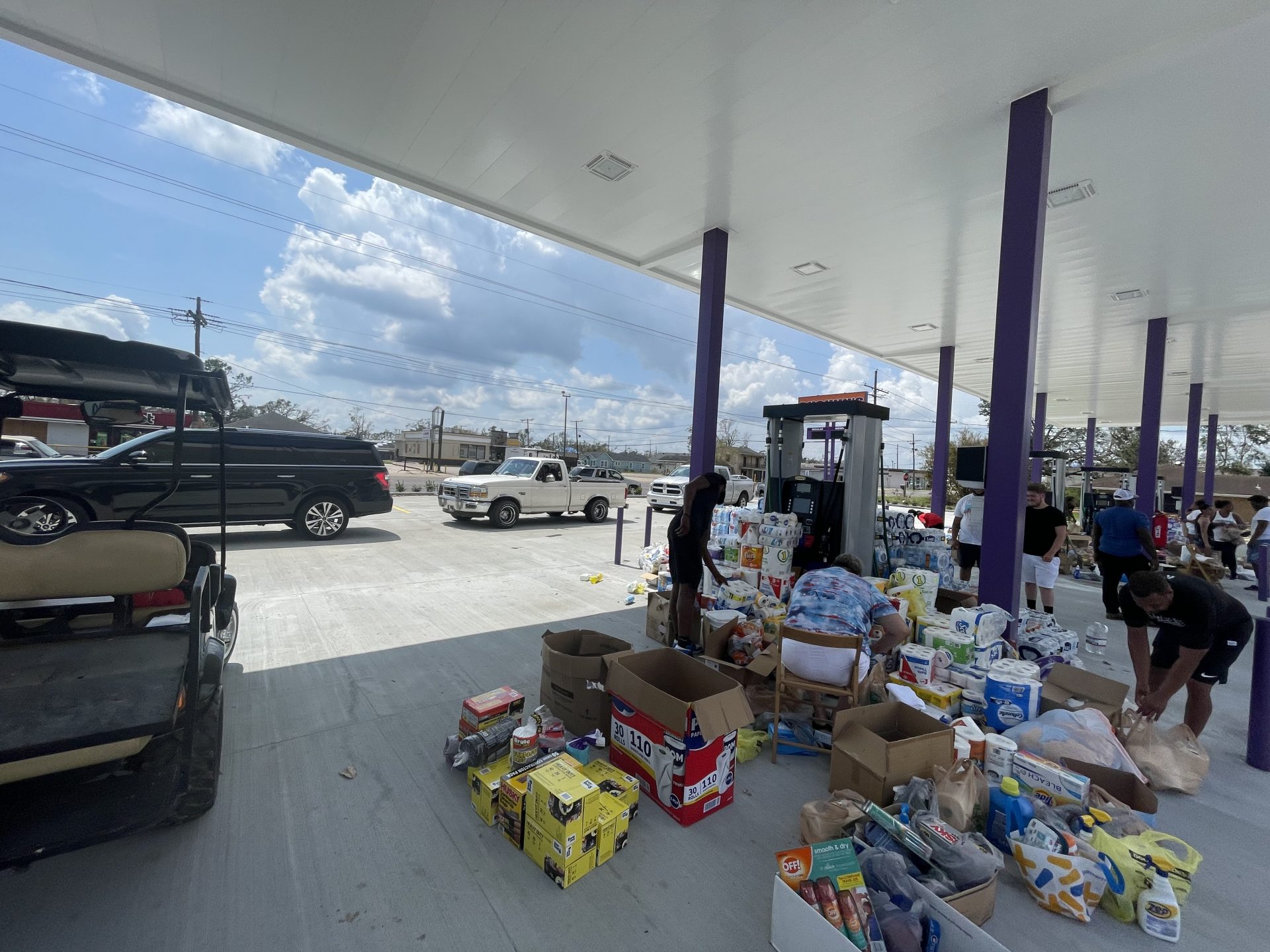
Tuesday, 9/14: Where to find what you need across our parishes
September 14, 2021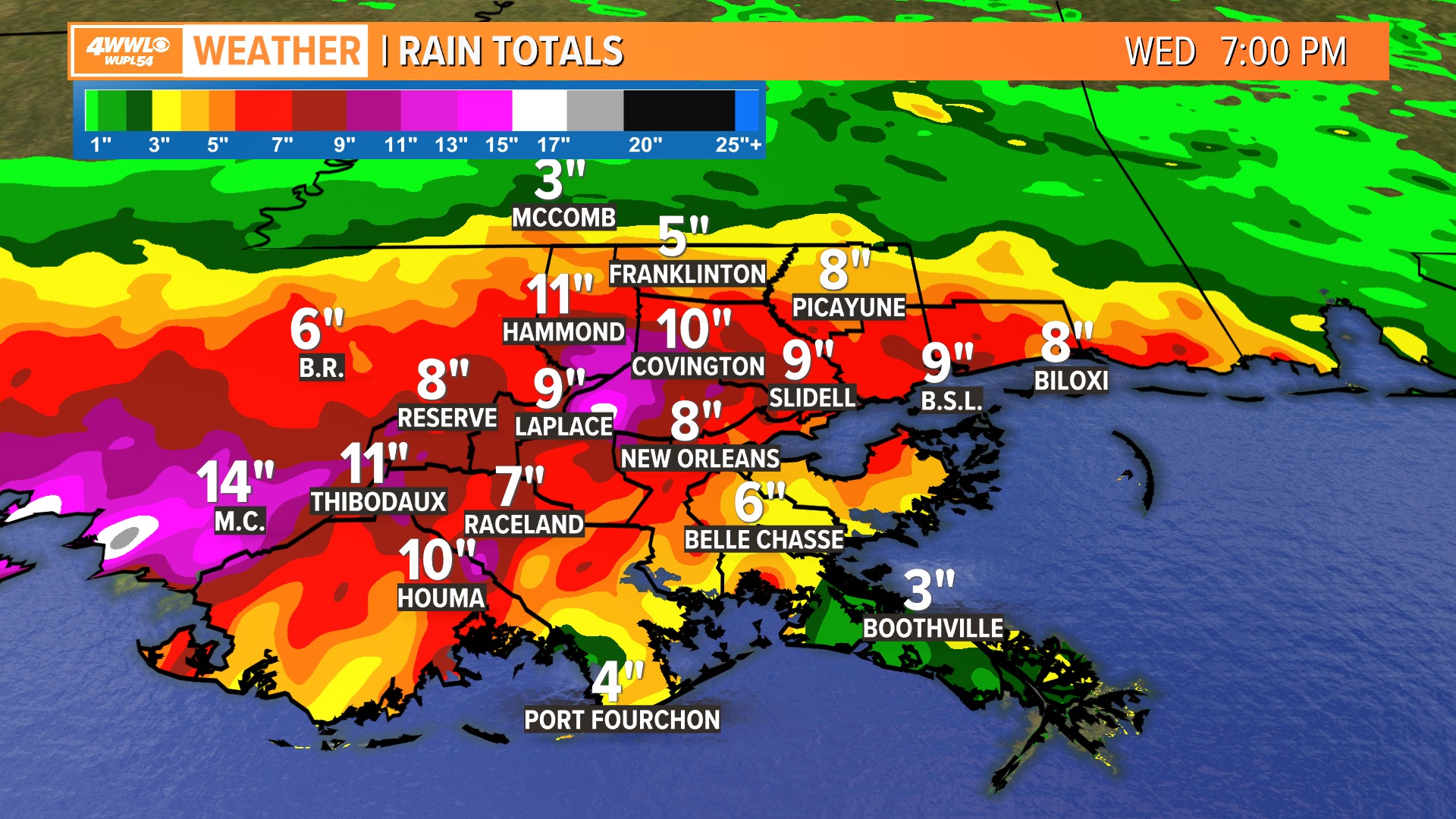
The rains have started throughout our area, and will continue into Thursday. Nicholas is likely to stall over south Louisiana over the next 48 hours with heavy rain threat extending well east of the system’s center into southeast Louisiana/south Mississippi. With debris not picked up in many places from Hurricane Ida, storm drains and ditches will likely clog, causing quicker street flooding than usual. Please don’t drive through flooded roadways.
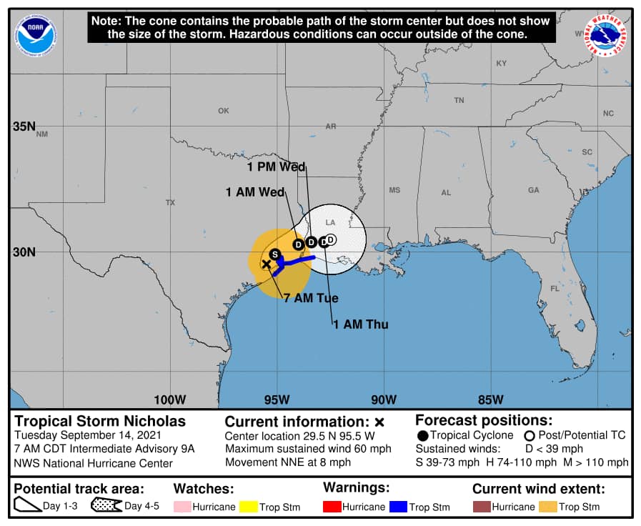
At 7 a.m. CDT, the center of Tropical Storm Nicholas was located inland over Texas about 15 miles (25 km) south-southwest of Houston and about 90 miles (145 km) west-southwest of Beaumont. Nicholas is moving toward the north-northeast near 8 mph (13 km/h) and that general motion should continue this morning. The storm should move more slowly to the northeast later today, and then turn eastward by Wednesday over Louisiana. Little motion is anticipated on Thursday.
Data from NOAA Doppler radars indicate that maximum sustained winds have decreased to near 60 mph (95 km/h) with higher gusts. Tropical-storm-force winds extend outward up to 125 miles (205 km) from the center. During the past couple of hours, a Weatherflow station near Galveston Bay, Texas, reported a 1-minute sustained wind of 39 mph (63 km/h) and a gust to 52 mph (84 km/h). Farther to the east, an observing station at Texas Point recently reported a 1-minute sustained wind of 37 mph (60 km/h) and a gust to 45 mph (72 km/h). The estimated minimum central pressure is 999 mb (29.50 inches) based on nearby surface observations. Nicholas should weaken further today as it moves farther inland, and the storm is forecast to become a tropical depression by Wednesday morning.
The combination of a dangerous storm surge and the tide will cause normally dry areas near the coast to be flooded by rising waters moving inland from the shoreline. The water could reach the following heights above ground somewhere in the indicated areas if the peak surge occurs at the time of high tide:
– Sargent, TX to High Island, TX including Galveston Bay…3-5 ft
– High Island, TX to Rutherford Beach, LA…2-4 ft
– Port Aransas, TX to Sargent, TX…1-3 ft
– Aransas Bay, San Antonio Bay, and Matagorda Bay…1-3 ft
– Rutherford Beach, LA to Intracoastal City, LA…1-3 ft
– Sabine Lake and Calcasieu Lake…1-3 ft
Nicholas is expected to produce additional rainfall of 5 to 10 inches from the upper Texas coastal area into central to southern Louisiana, far southern Mississippi and far southern Alabama, with isolated storm totals of 20 inches across central to southern Louisiana. Life-threatening flash flooding impacts, especially in urbanized metropolitan areas, are possible across these regions. Widespread minor to isolated major river flooding is expected across portions of the upper Texas Gulf Coast and southern Louisiana and Mississippi.

