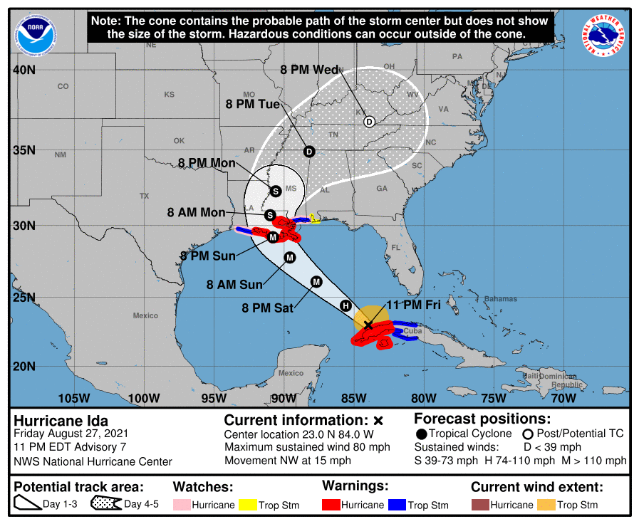
Ida enters the Gulf as a Category 1 storm, expected to intensify quickly overnight
August 27, 2021
Mandatory evacuations ordered for Terrebonne, Lafourche
August 28, 2021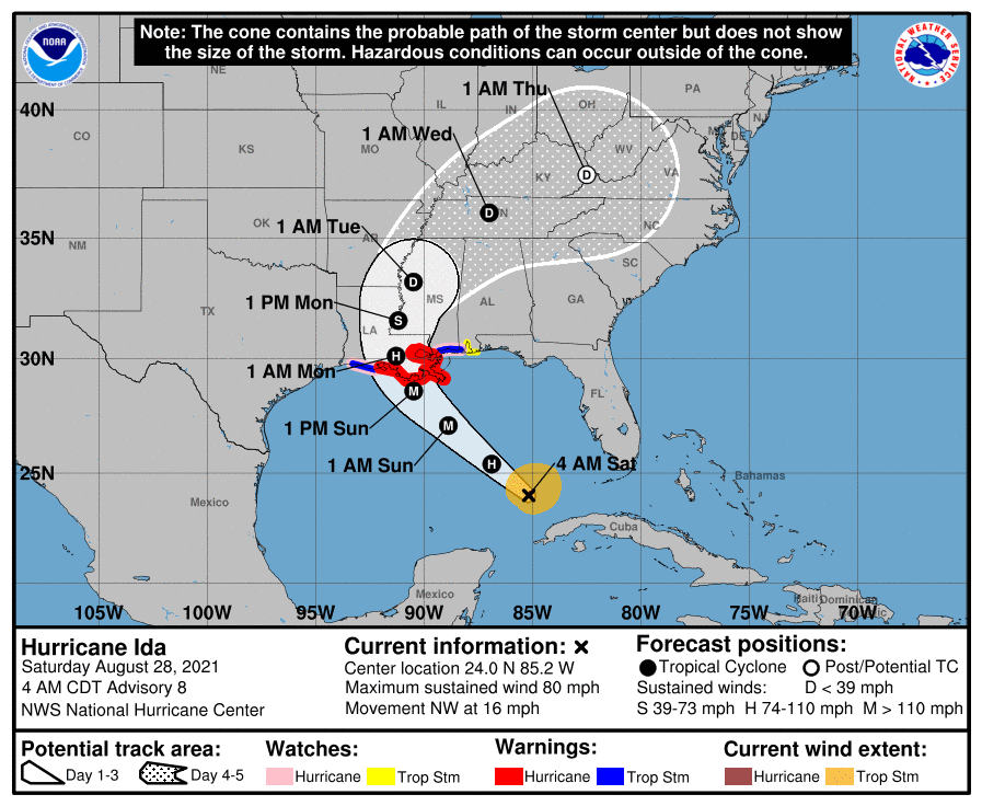
Hurricane Ida continues to move towards Louisiana. Winds are still at 80mph, with storm traveling at 16mph. It is still forecast to be a major Category 4 storm as it takes aim at Terrebonne and Lafourche. Please make preparations now for the storm.
At 400 AM CDT (0900 UTC), the center of Hurricane Ida was located near latitude 24.0 North, longitude 85.2 West. Ida is moving toward the northwest near 16 mph (26 km/h) and this general motion should continue through late Sunday or early Monday. A slower northward
motion is forecast on Monday. On the forecast track, the center of Ida will move over the southeastern Gulf of Mexico today and over the north central Gulf of Mexico on Sunday. Ida is then expected to make landfall along the U.S. northern Gulf coast within the hurricane warning area by late Sunday or early Monday, then move through portions of Louisiana or western Mississippi later on Monday.

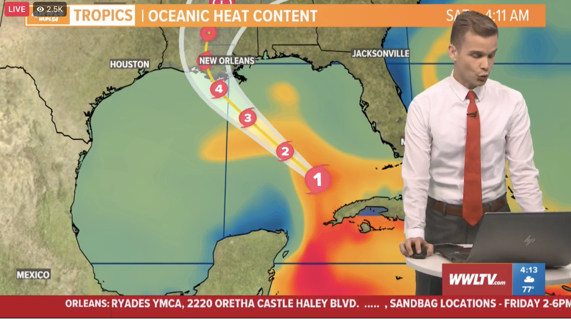
Maximum sustained winds are near 80 mph (130 km/h) with higher gusts. Rapid strengthening is forecast during the next 24 to 36 hours and Ida is expected to be an extremely dangerous major hurricane when it approaches the northern Gulf coast on Sunday. Weakening is expected after Ida makes landfall.
Hurricane-force winds extend outward up to 25 miles (35 km) from the center and tropical-storm-force winds extend outward up to 115 miles (185 km). The estimated minimum central pressure is 987 mb (29.15 inches).

