
Ochsner St. Anne Receives 2020 Press Ganey Guardian of Excellence Award for Patient Experience
October 9, 2020
LPSO: Concealed Handgun Course on October 10 Canceled; New Course Slated for October 24
October 9, 2020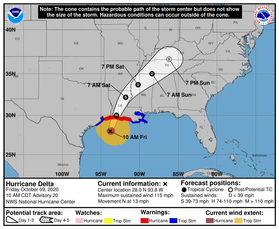
At 1000 AM CDT (1500 UTC), the center of Hurricane Delta was located near latitude 28.0 North, longitude 93.8 West. Delta is moving toward the north near 13 mph (20 km/h). A turn toward the north-northeast is expected this afternoon, followed by a northeastward
motion during the day Saturday. On the forecast track, the center of Delta should make landfall along the coast of southwestern Louisiana later this afternoon or this evening, and then move across central and northeastern Louisiana tonight and Saturday morning.
Maximum sustained winds are near 115 mph (185 km/h) with higher gusts. Delta is a category 3 hurricane on the Saffir-Simpson Hurricane Wind Scale. Slow weakening is expected before landfall, with rapid weakening expected after the center moves inland.

Hurricane-force winds extend outward up to 40 miles (65 km) from the center and tropical-storm-force winds extend outward up to 160 miles (260 km). NOAA buoy 42019 located west of the center of Delta recently reported sustained winds of 49 mph (79 km/h) and a wind gust of 60 mph (97 km/h).
The latest minimum central pressure reported by a NOAA Hurricane Hunter aircraft is 962 mb (28.41 inches).

