
Houma Tunnel to close for maintenance next week
April 9, 2021
Oil-Covered Brown Pelican Transported to Georgia After 2010 Deepwater Horizon Disaster Finds Its Way Back to Louisiana
April 9, 2021
Southeastern Louisiana will potentially see some severe storms Friday afternoon through Saturday morning.
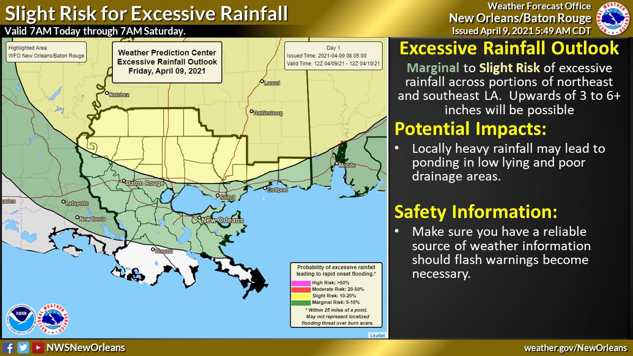
From the National Weather Service in New Orleans:
Update on Severe Weather Threat Friday afternoon through Saturday Morning
Changes from previous update:
* The severe weather risk levels have increased for all of the local area.
* Large hail of golf ball size or larger possible

Overview:
WHAT: Marginal to Moderate of severe weather
Marginal to Slight Risk of excessive rainfall/flash flooding
WHEN: A few isolated severe storms will be possible this afternoon, but the main threat will be overnight into Saturday morning. The lingering into Saturday morning is shown on the Day 2 severe weather risk graphic.
WHERE: The greatest severe weather threat will be across Southwestern Mississippi counties and the adjacent portions of Southeastern Louisiana, with the lowest threat across coastal Southeast Louisiana. The greatest heavy rainfall threat will generally be along and north of a line from New Orleans to Baton Rouge, including the MS Coast.
CONFIDENCE:
* We are confident there will be thunderstorms across the area
* Our confidence is increasing in some storms becoming severe and also producing heavy rainfall
Impacts:
Severe Weather Impacts:
* Large hail will be the primary threat Friday afternoon (golf ball or larger hail isn’t out of the question)
* Downed trees and powerlines, as well as minor structural damage from damaging winds or weak tornadoes
Heavy Rain Impacts:
* Streaks of 3 to 6 inches across parishes/counties with locally higher amounts, especially northeast of a line from New Orleans to Baton Rouge
* Ponding of water in low lying and poor drainage areas is likely
* Flash flooding will be possible
* Rises on area rivers are expected, with additional or worsening river flooding possible – especially across the north shore and MS Coastal basin

