Gov. Edwards Announces $1.8 Billion Louisiana Port Expansion Project
December 13, 2022
Free Christmas Lunch to be held on Dec. 18
December 13, 2022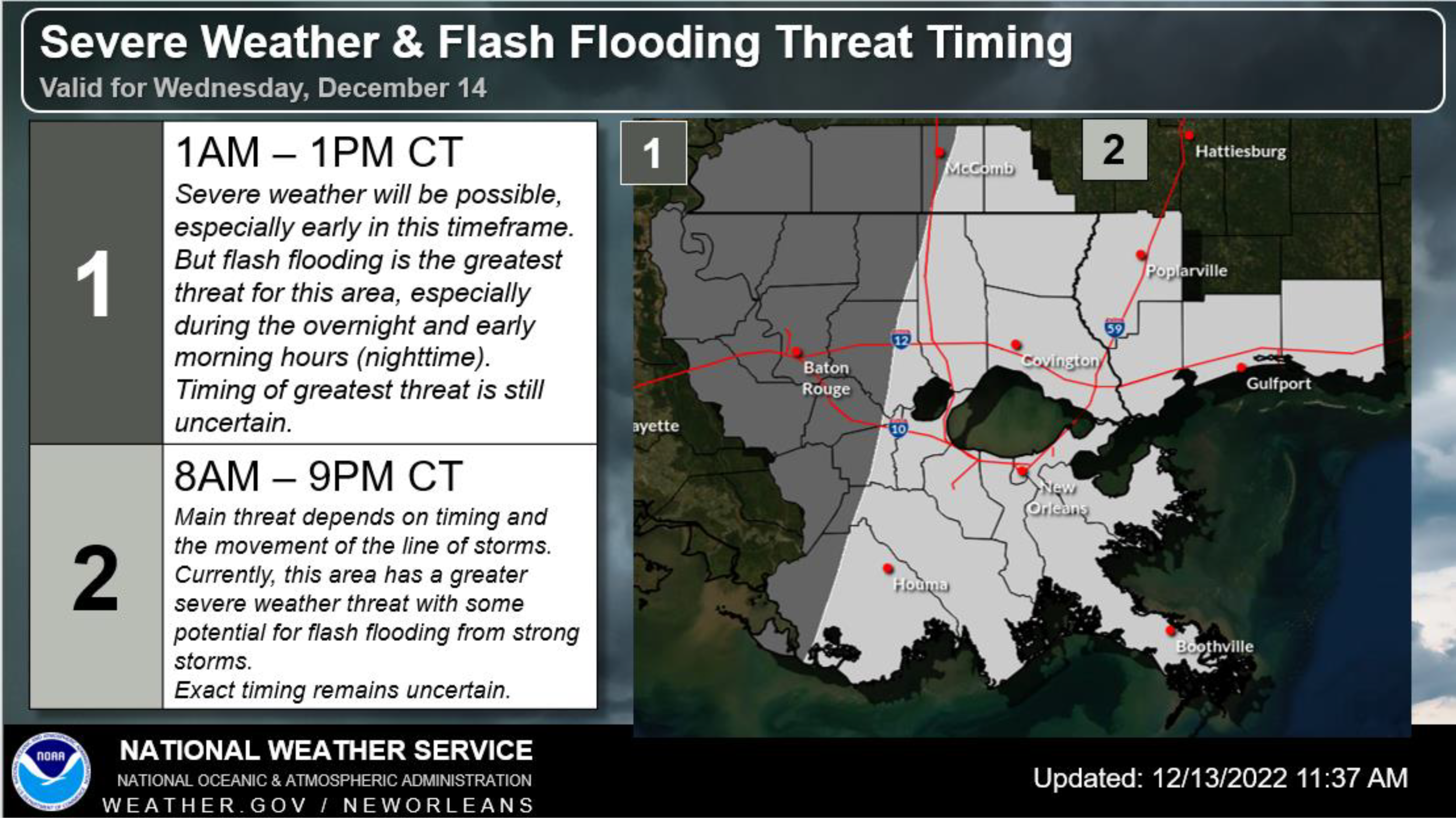
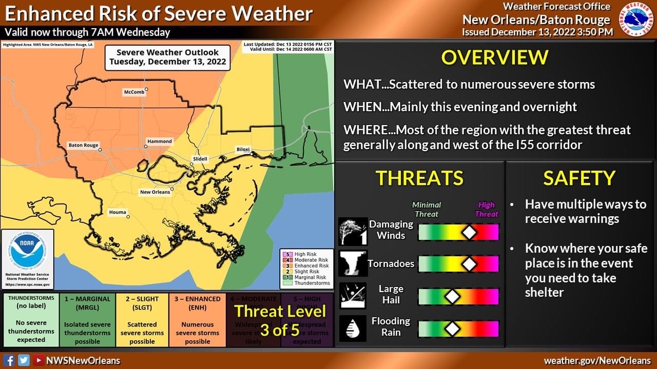
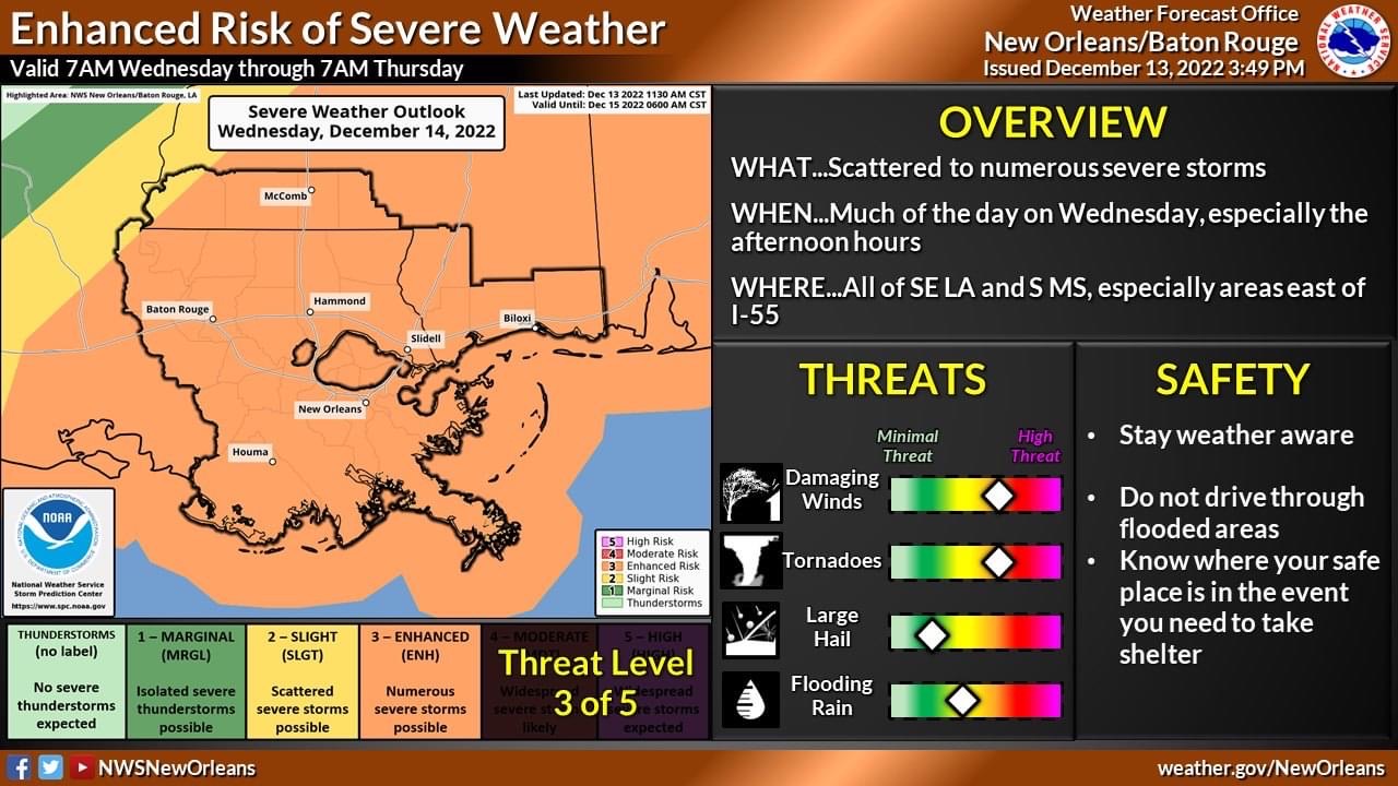
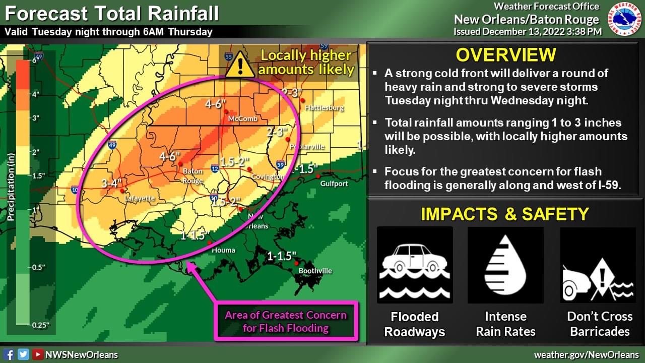
From the National Weather Service in New Orleans:
Overview:
WHAT: Enhanced Risk of Severe Weather and Moderate Risk of Heavy Rainfall.
WHEN: This evening through Wednesday evening.

WHERE: All of SE LA and southern MS.
CONFIDENCE: Timing remains a lower confidence as there is a possibility of a line of storms either slowing, or stalling early Wednesday, then re-development of more storms during the day Wednesday into Wednesday night as storms continue east.
This causes a concern for local training of thunderstorms and for now, low to moderate confidence on location of greatest flash flooding potential.

Impacts:
The main threats associated with any severe storms, damaging winds and tornadoes. The greatest severe threat overnight is north and west of a line from McComb to Baton Rouge.
Overall, expecting 2-4″ of rain, but locally double amounts are possible especially in strong thunderstorms and training /back building is possible.
Flood Watch is active for Terrebonne Parish for Wednesday from Midnight to 9PM.