What does the Quarantine process look like for a Nicholls student living on-campus?
September 12, 2020
Voluntary evacuation issued for Grand Isle
September 12, 2020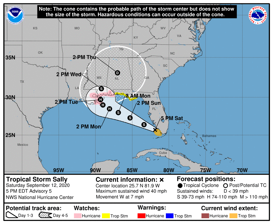
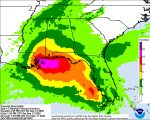
The latest forecast map shows the track of Tropical Storm Sally shifting to the east, with landfall around the mouth of the Mississippi River. Storm surge and hurricane warnings have been issued along the Gulf Coast. At this time, Terrebonne and Lafourche are not included (with the exception of Grand Isle).
At 5 p.m. EDT, the center of Tropical Storm Sally was located about 30 miles (45 km) south-southwest of Naples. Sally is moving toward the west near 7 mph (11 km/h), and a turn toward the west-northwest is expected tonight. A west-northwestward or northwestward motion is then expected during the next couple of days. On the forecast track, the center is forecast to move over the southeastern and eastern Gulf of Mexico tonight and Sunday, and then move over the north-central Gulf of Mexico Sunday night and Monday.
A Storm Surge Watch is in effect for:
* Mouth of the Mississippi River to the Alabama/Florida state line
* Lake Pontchartrain, Lake Maurepas, and Lake Borgne
* Mobile Bay

A Hurricane Watch is in effect for:
* Grand Isle, Louisiana to the Alabama/Florida state line
* Lake Pontchartrain and Lake Maurepas including metropolitan New Orleans
A Tropical Storm Watch is in effect for:
* Alabama/Florida state line to Ochlockonee River Florida
Hurricane conditions are possible within the hurricane watch area by early Tuesday, with tropical storm conditions possible within the watch area by Monday.

Maximum sustained winds are near 40 mph (65 km/h) with higher gusts. Tropical-storm-force winds extend outward up to 80 miles (130 km) from the center. Strengthening is expected to occur during the next couple of days, and Sally is forecast to become a hurricane on Monday.
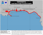
The combination of a dangerous storm surge and the tide will cause normally dry areas near the coast to be flooded by rising waters moving inland from the shoreline. The water could reach the following heights above ground somewhere in the indicated areas if the peak surge occurs at the time of high tide:
– Mouth of the Mississippi River to Ocean Springs, MS incl. Lake Borgne…6-9 ft
– Ocean Springs, MS to MS/AL state line…4-6 ft
– MS/AL state line to AL/FL Border, incl. Mobile Bay…2-4 ft
– Lake Pontchartrain and Lake Maurepas…2-4 ft
– AL/FL state line to Chassahowitzka, FL, including Pensacola Bay, Choctawhatchee Bay, and Saint Andrew Bay…1-3 ft

