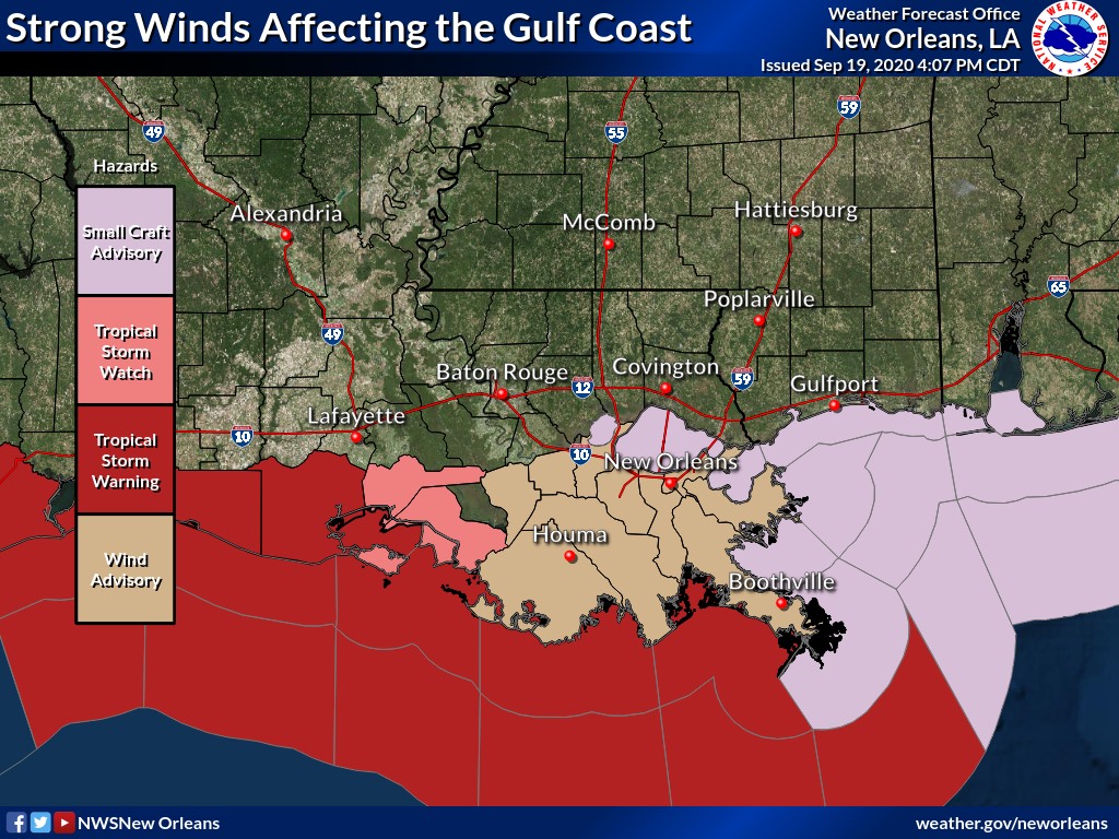
Wind Advisory in effect for Terrebonne and Lafourche
September 19, 2020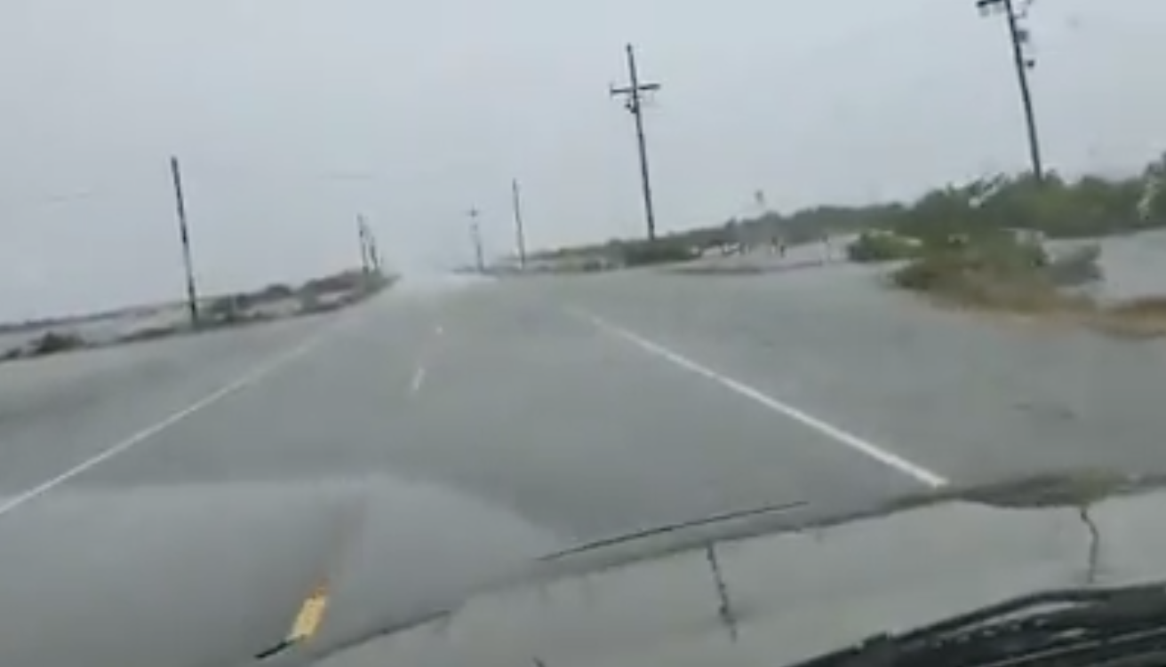
LA 1 closed to small car traffic as water overtops road south of Golden Meadow; Trucks, SUVs allowed
September 20, 2020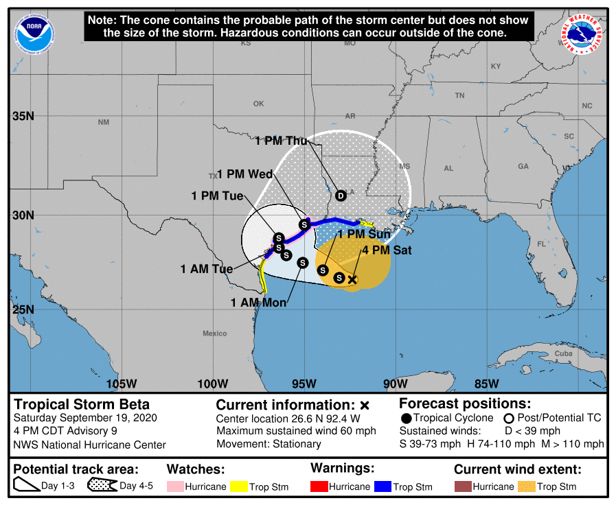
With no significant changes at the 4pm update, Beta is currently stationary which is not entirely unexpected given its slow movement. It is expected to drift westward through Monday before turning northeastward on Tuesday. Due to Beta’s slow movement, there will be a prolonged period of wet weather through next week. Flash flooding could become a concern depending on the location and duration of the heaviest rain.
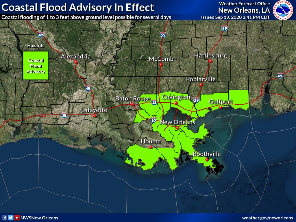
A Coastal Flood Advisory is in effect for all coastal areas of SE LA and S MS. Gusty winds are possible mainly south of the I-10 corridor and a wind advisory has been posted. Stronger winds are possible across the coastal waters and Tropical Storm Warnings and Small Craft Advisories are posted.
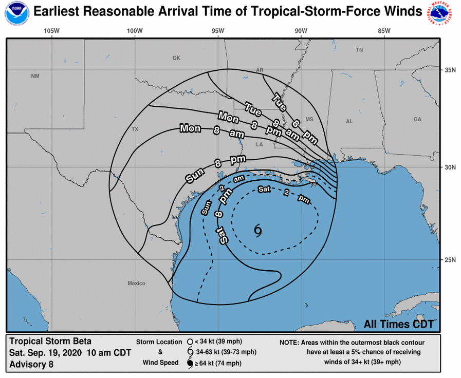
At 400 PM CDT (2100 UTC), the center of Tropical Storm Beta was located near latitude 26.6 North, longitude 92.4 West. Beta has been nearly stationary for the past several hours. A westward drift is expected tonight, followed by a slow motion toward the west-northwest that should continue through late Monday. On the forecast track, the center of Beta will slowly approach the Texas coast Sunday and Monday.

Maximum sustained winds are near 60 mph (95 km/h) with higher gusts. Slow strengthening is expected during the next couple of days, and Beta could be near hurricane strength as it approaches the
Texas coast.
Tropical-storm-force winds extend outward up to 175 miles (280 km) from the center, mainly in the northern semicircle. A ship near the center of Beta recently reported winds of 54 mph (87 km/h). The estimated minimum central pressure is 994 mb (29.36 inches).

