
Lawrence Joseph Pitre, Jr.
June 21, 2023
Southern Feathers Aviary to host Thibodaux’s first ever Exotic Pet Expo
June 21, 2023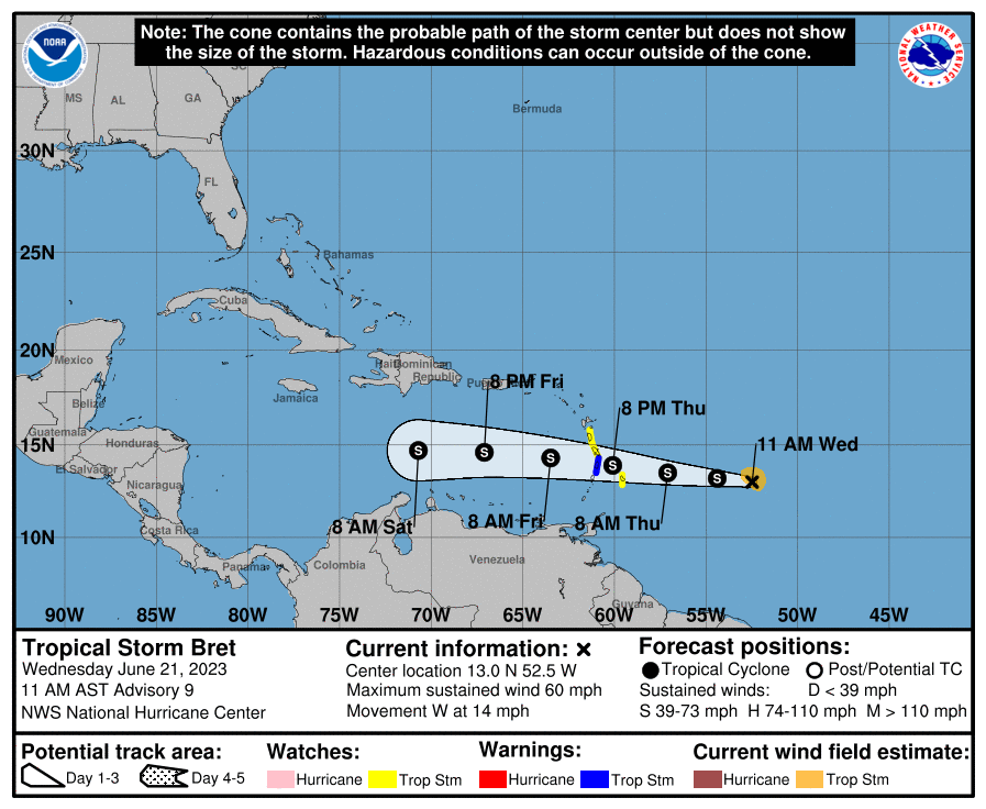
We continue to keep an eye on Tropical Storm Bret as is moves across the Atlantic. Weakening is expected by Friday once Bret moves over the Caribbean Sea, and the system is likely to dissipate on Saturday.

The other disturbance in the Central Tropical Atlantic looks more organized. A tropical depression will likely form during the next couple of days.
From National Weather Service:
At 1100 AM AST (1500 UTC), the center of Tropical Storm Bret was located near latitude 13.0 North, longitude 52.5 West. Bret is moving toward the west near 14 mph (22 km/h), and this general motion with an increase in forward speed is expected during the next several days. On the forecast track, the center of Bret is expected to approach the Lesser Antilles on Thursday, move across the Lesser Antilles late Thursday and Thursday night, and then move westward across the eastern and central Caribbean Sea Friday and Saturday.
Maximum sustained winds are near 60 mph (95 km/h) with higher gusts. Some increase in strength is forecast before Bret reaches the Lesser Antilles. Weakening is expected by Friday once Bret moves over the Caribbean Sea, and the system is likely to dissipate on Saturday.
Tropical-storm-force winds extend outward up to 60 miles (95 km) from the center. The estimated minimum central pressure is 1001 mb (29.56 inches).
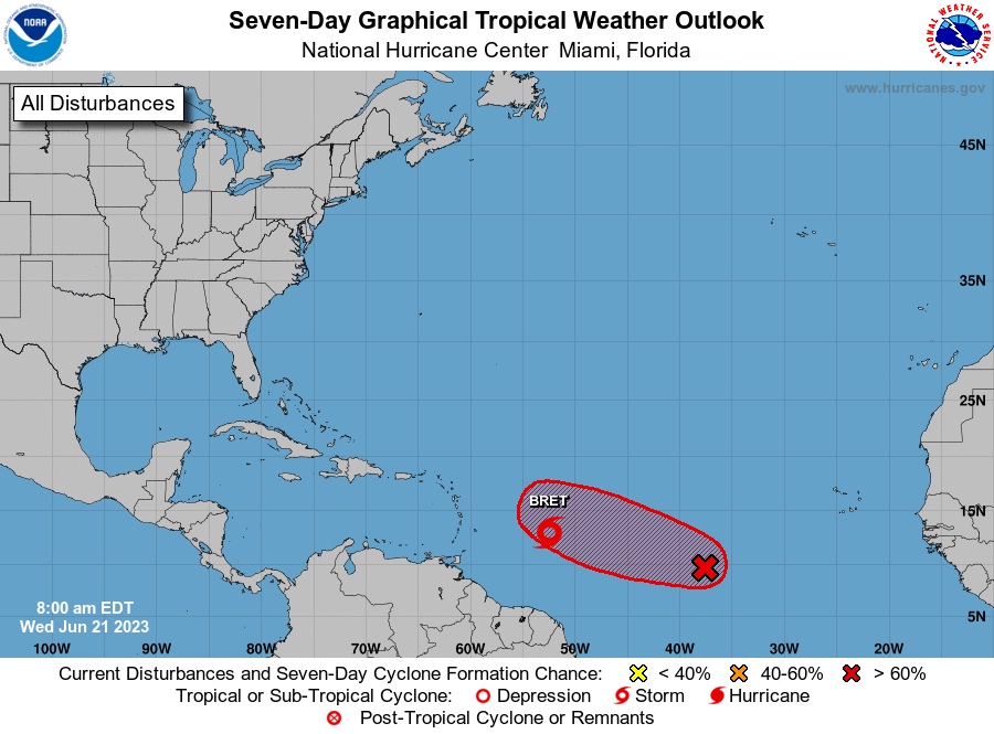
Satellite images indicate that the broad area of low pressure located about midway between the west coast of Africa and the Lesser Antilles has become better organized overnight. Environmental conditions appear conducive for further development of this system, and a tropical depression will likely form during the next couple of days. This system is expected to move westward to west-northwestward at 10 to 15 mph across the central tropical Atlantic through the early part of the weekend.
The next name is Cindy.
* Formation chance through 48 hours…high…70 percent.
* Formation chance through 7 days…high…80 percent.

