
Dularge Bridge will be intermittently closed to vehicular traffic today
October 10, 2023
Kenneth Paul Voisin
October 10, 2023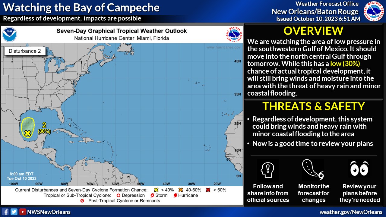
Here is an update from the National Weather Service in New Orleans concerning the potential for tropical cyclone development in the southwest Gulf of Mexico and local heavy rain threat for the area.
Overview:
• There is a LOW (30%) chance of tropical cyclone development over the next 7 days.
• This system is forecast to move generally northward slowly towards the north Gulf coast, then northeast.
• Regardless of tropical formation, impacts from heavy rainfall and gusty winds are possible Wednesday into early Thursday.
Confidence:
Confidence in regards to tropical development is low, however confidence is higher that there will be impacts regardless of development – including heavy rain and gusty winds.
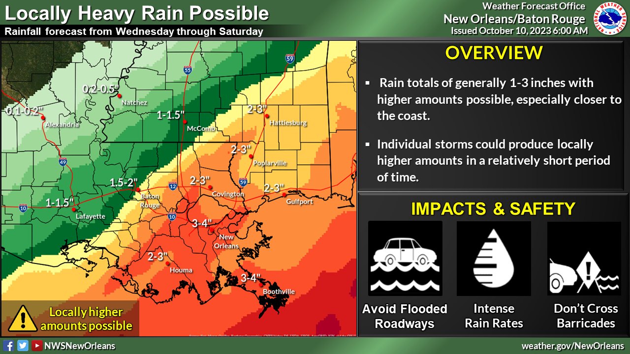
Impacts:
Heavy Rainfall:
General area average of 1 to 3 inches of rainfall will be possible across the area. Higher totals will be along coastal areas of SE LA and SE MS. Some minor flooding is possible – primarily along coastal areas.
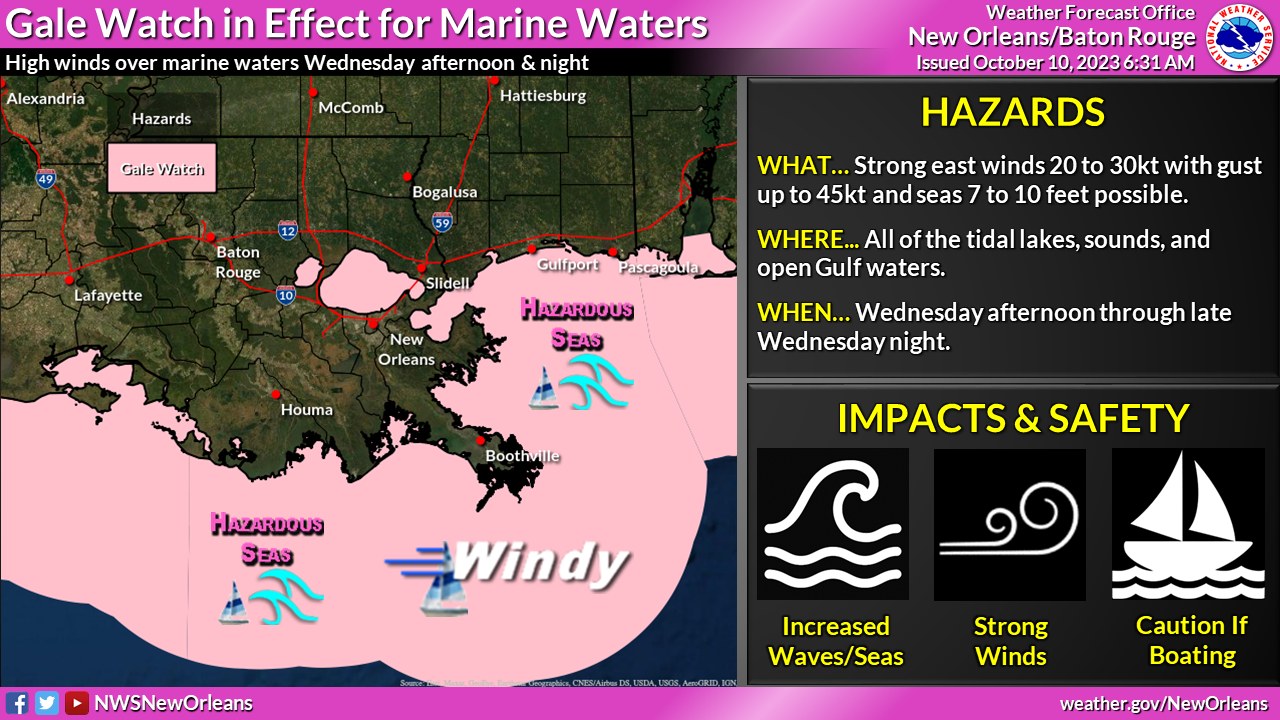
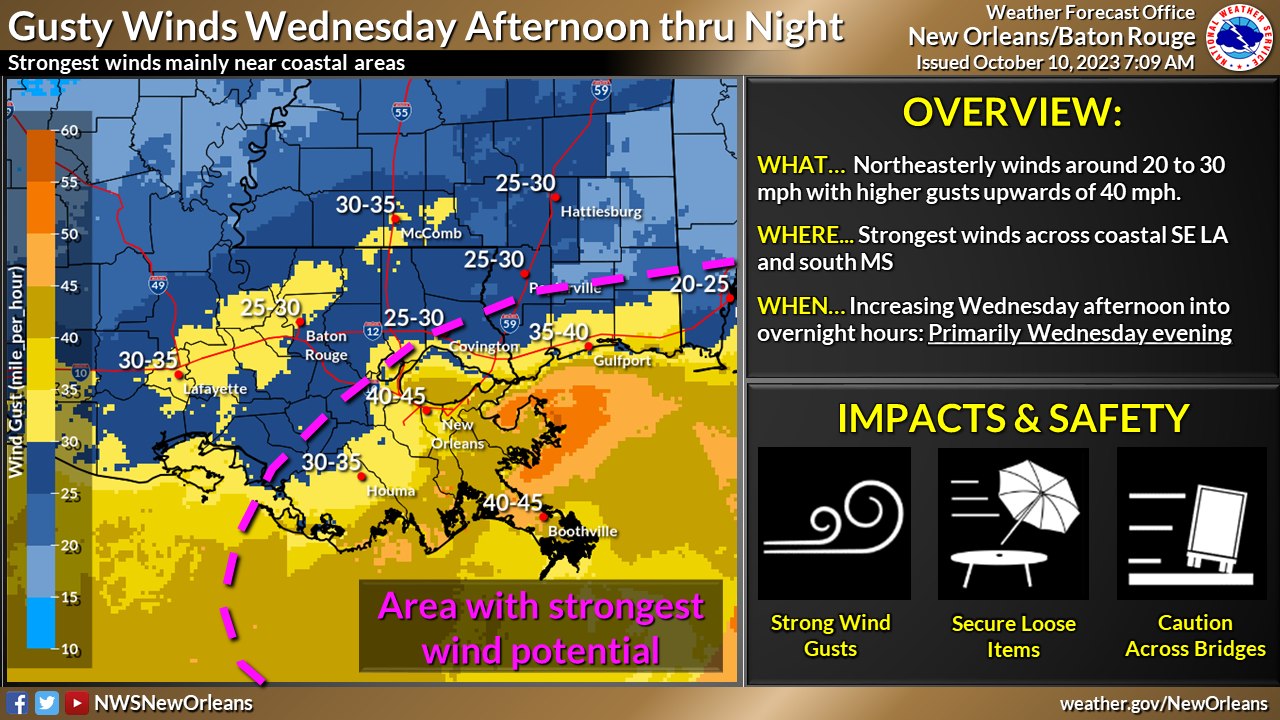
Wind:
Gusty winds will be possible – primarily Wednesday afternoon thru overnight and focused along coastal areas of SE LA and S MS. Cross winds could be an issue for high profile vehicles and for traffic on north-to-south oriented bridges and other elevated surfaces.
Minor Coastal Flooding:
Elevated tides and the potential for minor coastal flooding – primarily for east-facing shorelines will be possible Wednesday thru Thursday.

Related posts

May 8, 2024