
Cut Off Youth Center to host Hurricane Festival after two year hiatus
September 20, 2022
TPCG to host final Hurricane Ida Recovery Community Meeting
September 20, 2022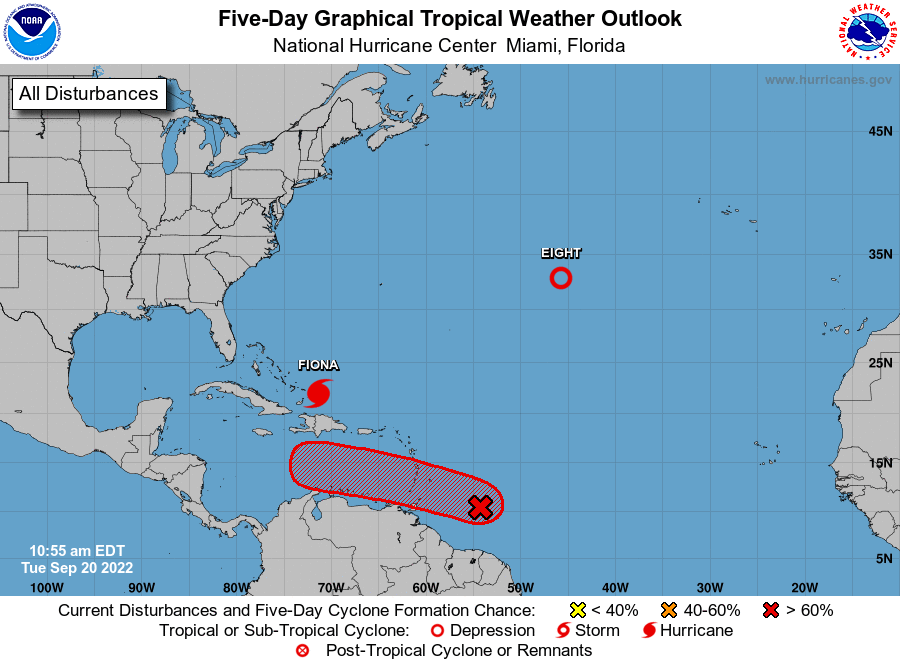
The National Hurricane Center is issuing advisories on Hurricane Fiona, located near the Turks and Caicos islands, and on newly formed Tropical Depression Eight, located over the north-central Atlantic Ocean. The next names on the list are Gaston and Hermine.

Satellite data indicate that the tropical wave located several hundred miles east of the Windward Islands has become better organized this morning. Additional development is expected, and a tropical depression is likely to form within the next few days as the system moves westward to west-northwestward at 15 to 20 mph across the eastern and central Caribbean Sea. Interests in the Windward Islands should closely monitor the progress of this system as heavy rainfall and gusty winds could affect these islands beginning on Wednesday.
* Formation chance through 48 hours…medium…40 percent.
* Formation chance through 5 days…high…70 percent.
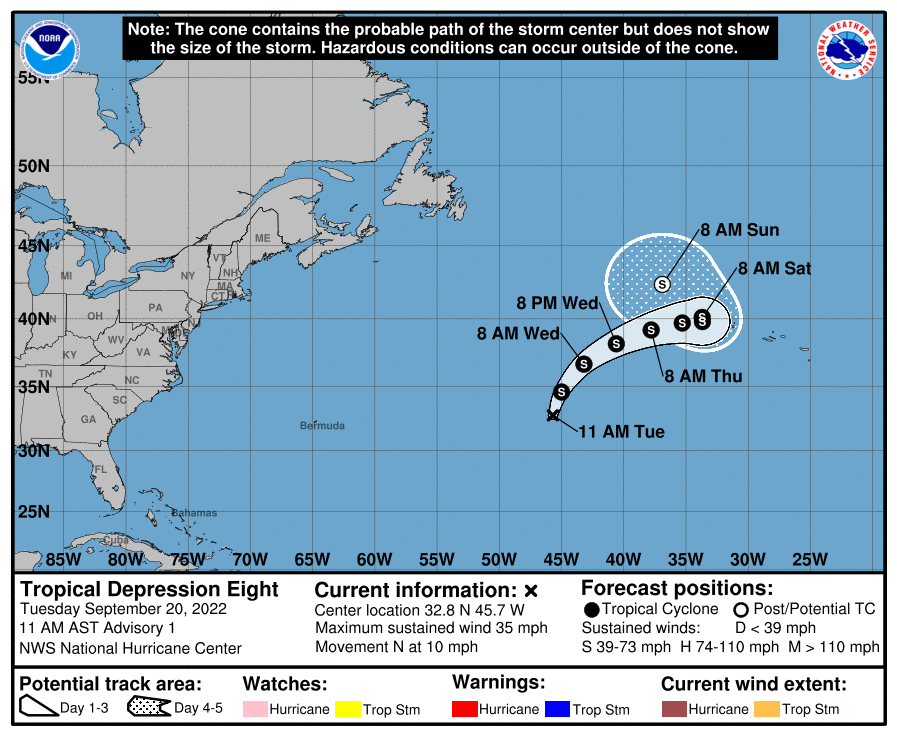
At 1100 AM AST (1500 UTC), the center of Tropical Depression Eight was located near latitude 32.8 North, longitude 45.7 West. The depression is moving toward the north near 10 mph (17 km/h). A turn to the northeast is expected on Wednesday, followed by a motion to the east. Maximum sustained winds are near 35 mph (55 km/h) with higher gusts. Slow strengthening is forecast, and the depression is expected to become a tropical storm later today or tonight. The estimated minimum central pressure is 1013 mb (29.92 inches).

