
Donate gently worn glasses to Chiasson Eyecare Center
September 13, 2022
Woodmen Life Trivia Night to benefit Terrebonne Churches United Food Bank
September 13, 2022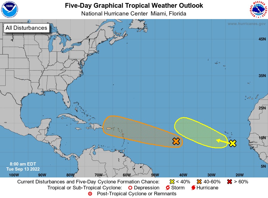
This Tuesday, conventional and Low-earth orbit satellite data indicate that showers and thunderstorms associated with a tropical wave located about midway between the west coast of Africa and the Windward Islands have increased and become better organized since yesterday afternoon. Further development of this system is possible and a tropical depression could form over the next several days while it generally moves westward to west-northwestward over the central tropical Atlantic and approaches the Leeward Islands on Friday. It has a low (30 percent) chance in the next 48 hours and a medium (40 percent) chance in the next 5 days.
In the eastern Tropical Atlantic, showers and thunderstorms have changed little overnight in association with a tropical wave approaching the Cabo Verde Islands. Environmental conditions appear only marginally favorable, and any development of this system should be slow to occur while it moves westward or west-northwestward across the eastern tropical Atlantic through the end of the week. It has a near zero chance of development in the next 48 hours and a low (20 percent) chance in the next 5 days.

