
Katie Louviere & Andrew Gilmer Crowned Nicholls 2023 Homecoming Royalty
October 10, 2023
Thibodaux Regional to host Circle of Hope Love Life Luncheon
October 10, 2023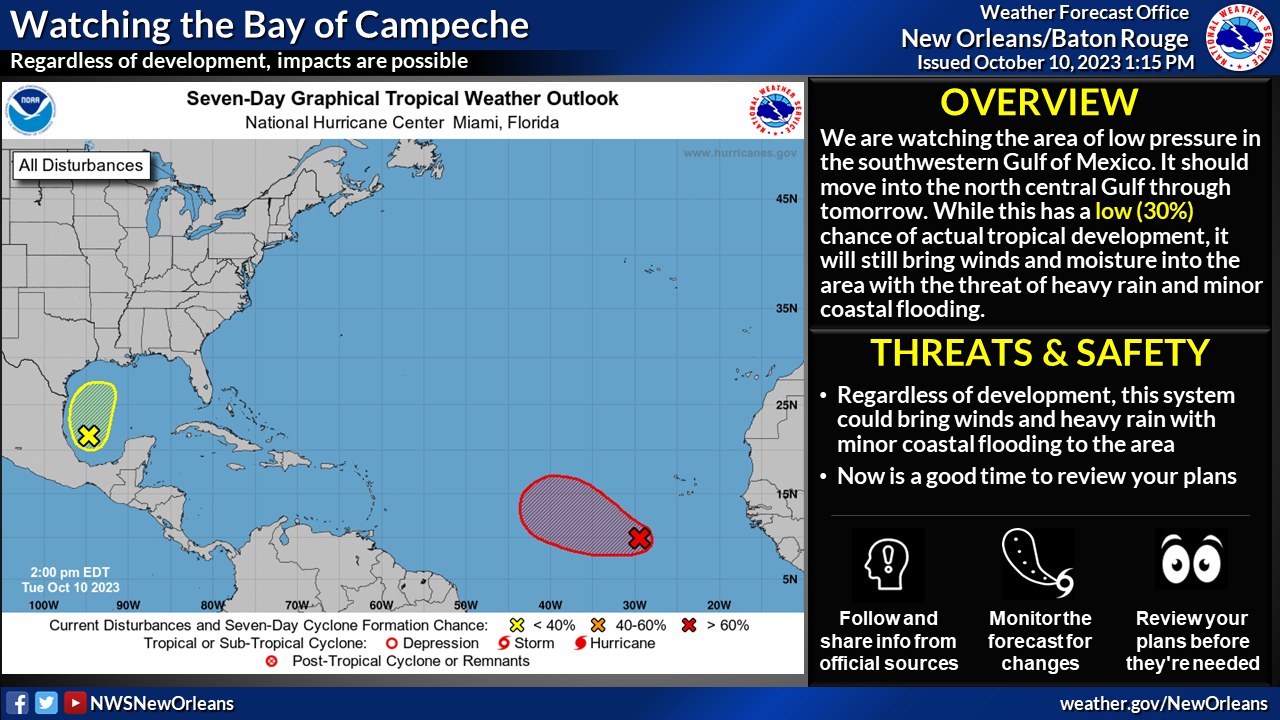
Here is an update from the National Weather Service in New Orleans concerning the potential for tropical cyclone development in the southwest Gulf of Mexico and local heavy rain threat for the area.
Changes from Previous Update:
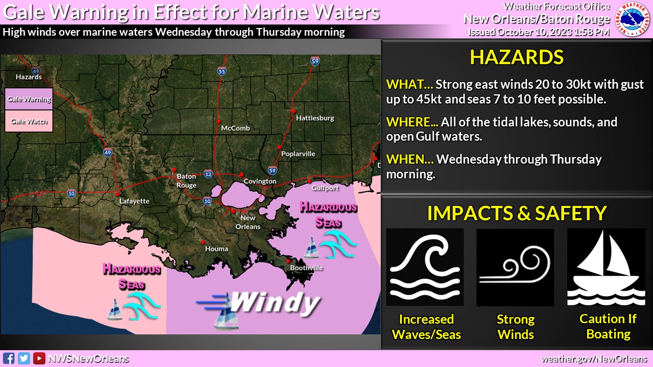
• The Gale Watch has been upgraded to a Gale Warning for all of our marine waters, including the tidal lake and sounds, interior and outer waters for Wednesday morning through Thursday
• A Wind Advisory is in effect for Wednesday afternoon into Wednesday night for areas south of I-10.
• A Coastal Flood Warning is in effect for Wednesday night through Thursday for inundation 1-3 feet for areas around the tidal lakes, as well as St Bernard and Plaquemines Parishes and Hancock County
• A Coastal Flood Advisory is in effect for northshore areas of Lake Pontchartrain with inundation 1-2 feet expected Wednesday night into Thursday
Overview:
•There is a LOW (30%) chance of tropical cyclone development over the next 7 days.
• This system is forecast to move generally northward slowly towards the north Gulf coast, then northeast.
Regardless of tropical formation, impacts from heavy rainfall and gusty winds are possible Wednesday into early Thursday.
Confidence:
Confidence in regards to tropical development is low, however confidence is higher that there will be impacts regardless of development – including heavy rain, minor coastal flooding, and gusty winds.
Impacts:
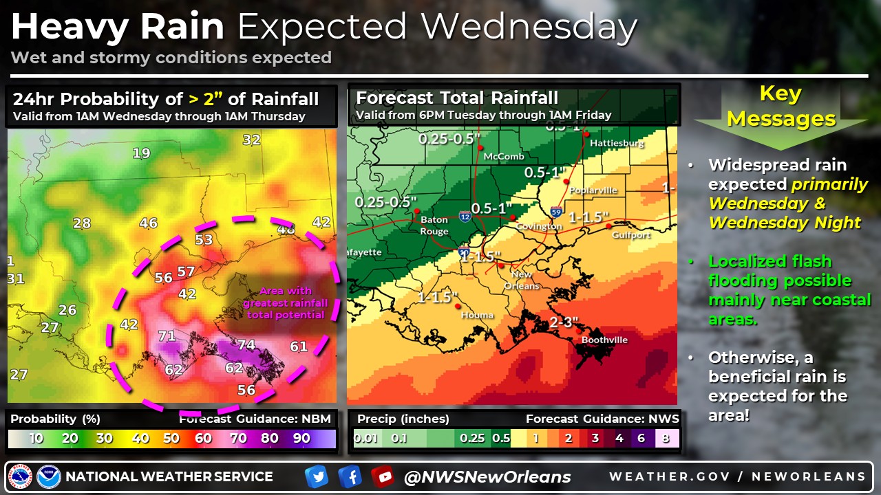
Heavy Rainfall:
• General area average of 1 to 3 inches of rainfall will be possible across the area. Higher totals will be along coastal areas of SE LA and SE MS.
• Good chance (50-60%) of seeing rainfall amounts greater than 2″ total Wednesday into Thursday
• Some minor flooding is possible – primarily along coastal areas.
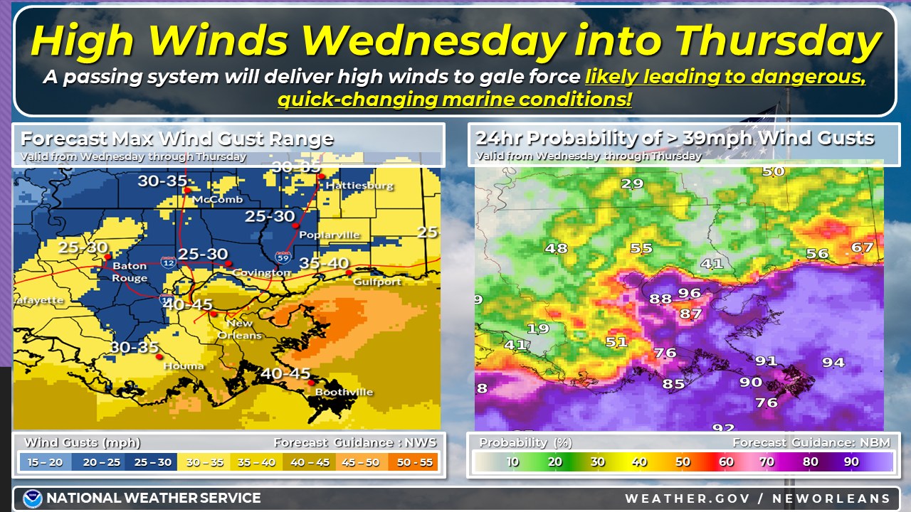
Wind:
• Gusty winds 25-30mph with gusts around 40mph will be possible – primarily Wednesday afternoon thru overnight and focused along coastal areas of SE LA, especially areas along southshores of Lake Pontchartrain and Lake Borgne
• Very high chance (80-90%) of seeing wind gusts greater than 39mph for areas along the southshore and coastal Louisiana
• Cross winds could be an issue for high profile vehicles and for traffic on north-to-south oriented bridges and other elevated surfaces
Minor Coastal Flooding:
• Elevated tides and the potential for minor coastal flooding of 1-3 feet inundation for areas in the coastal flood warning and 1-2 feet inundation for areas in the coastal flood advisory – Wednesday night through Thursday

Related posts

May 8, 2024