
Firefighters battling structure fire near Evergreen Junior High
May 21, 2021
Jane Bundy
May 21, 2021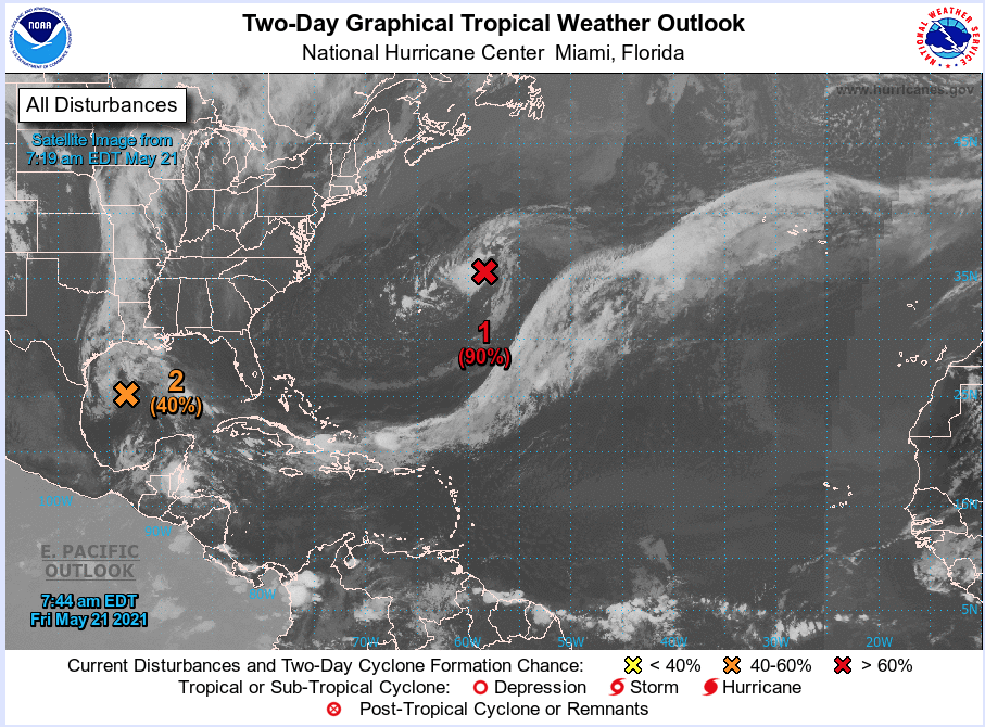
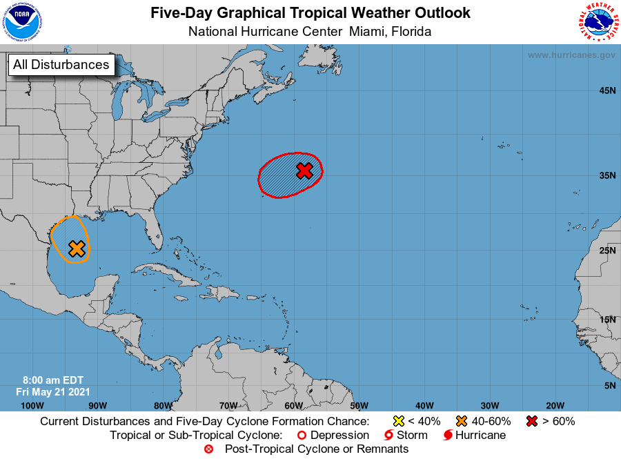
Even though the official start to hurricane season isn’t until June 1, two disturbances are slowly gaining strength in the Atlantic and the Gulf of Mexico.
The 7AM forecast from the National Hurricane Center places the Atlantic disturbance at a 90 percent chance of formation in the next 48 hours. This storm would potentially become Ana. The low has not yet acquired subtropical storm characteristics. However, if current trends continue advisories could be initiated on the system later today or tonight as it moves westward to west-southwestward to the northeast of Bermuda. Subsequently, the low is forecast to move northeastward into a more hostile environment by Saturday night or Sunday.

Invest 91L, the low-level circulation that is helping to keep our area wet, is still moving around in the Gulf. NHC places this area at a 40 percent chance of development in the next 48 hours. shower and thunderstorm activity remains disorganized. Environmental conditions are expected to be marginally conducive for development, and a short-lived tropical depression or storm could form before the disturbance moves inland over the northwestern Gulf coast tonight. Regardless of development, the system could produce heavy rainfall over portions of southeastern Texas and southwestern Louisiana during the next few days. The next name on the list after Ana is Bill.
If either storm does indeed form this weekend, it would continue the 5+ year streak of first named storm arriving before June 1.
