
Thibodaux City Marshal Calvin Cooks, Sr. Scholarship Program Now Accepting Applications
March 17, 2022Gov. Edwards Announces PRO Louisiana Workforce Development Program
March 17, 2022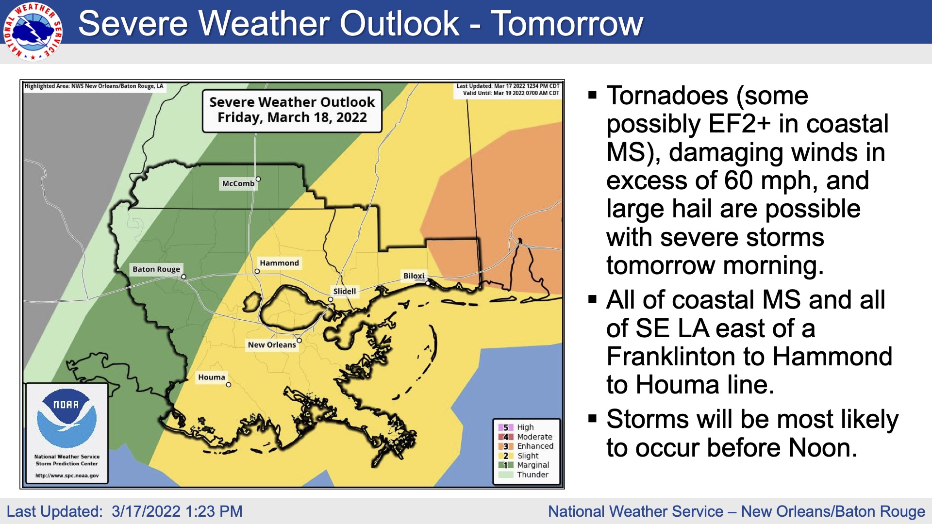
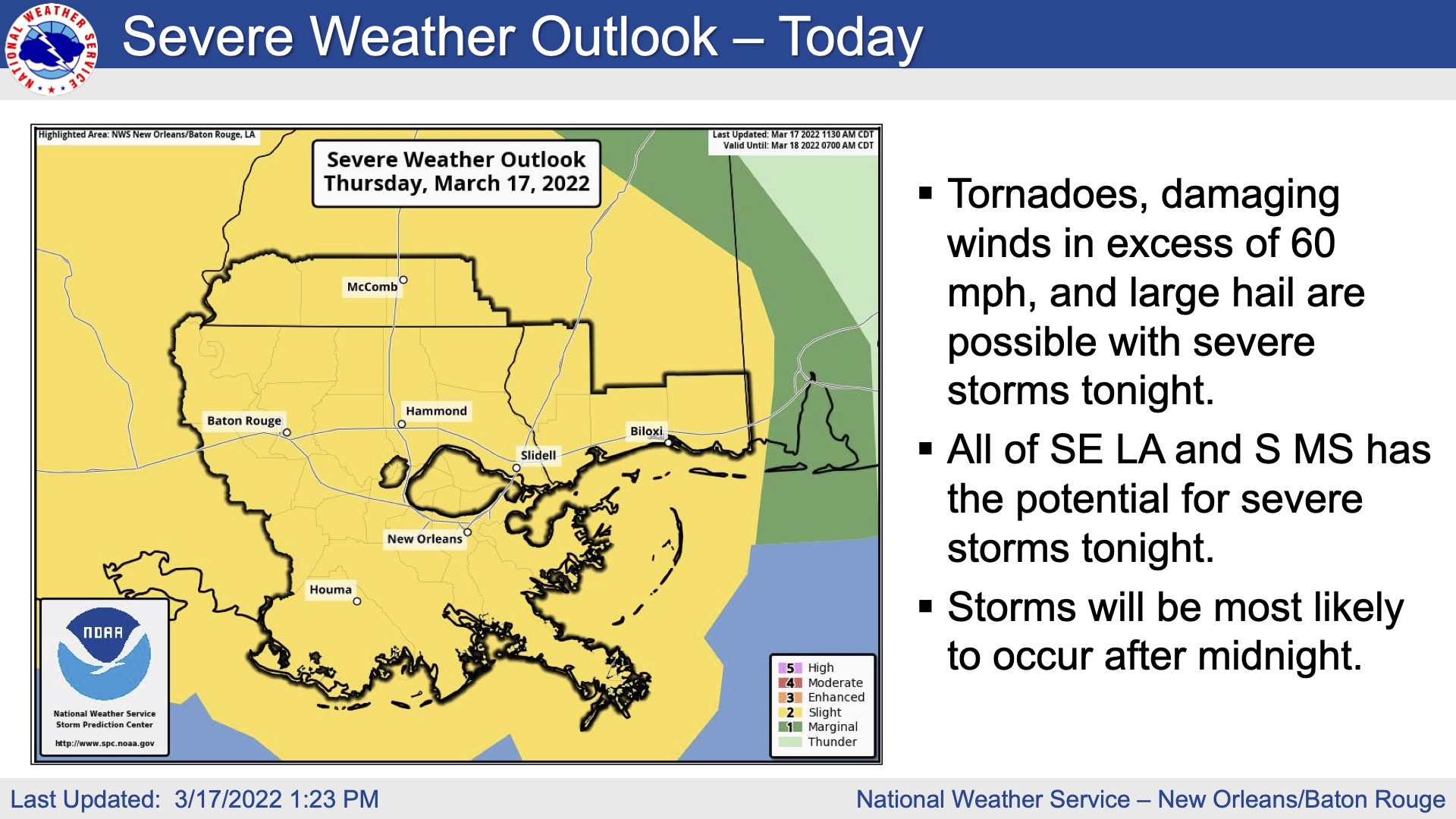
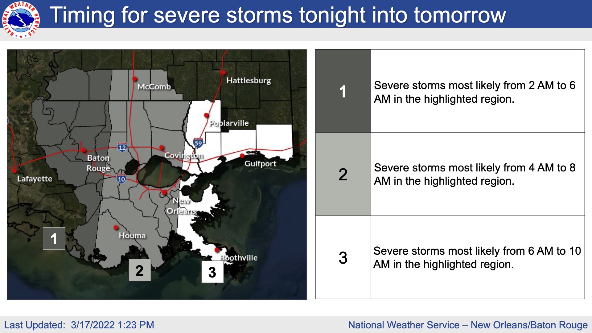
The National Weather Service is highly confident that strong to severe thunderstorms will develop late tonight into tomorrow morning over our portions of southeast Louisiana.
The main threats associated with any severe storms will be:

• Wind gusts greater than 60 mph will be possible
• Trees and powerlines could be damaged and lead to isolated/scattered power outages
• Large hail up to 1.5 inches in diameter will be possible

• Wind blown hail could cause additional damage
• Tornadoes will be possible, and a few could be strong and/or long track
In addition to the severe weather threat, rainfall of 1 to 2 inches is forecast with locally higher amounts possible. This rainfall could lead to ponding of water in low lying areas and areas of poor drainage.
