
Take charge of your own health at the National Patient Recognition Week Health & Wellness Event
January 13, 2024
Gala Goes 80s Prom Court Announced
January 13, 2024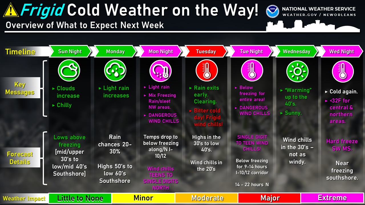
From the National Weather Service:
1:30PM 1/13/24: You’ve likely been hearing all about the brutal cold air coming in next week. Let’s take a closer look breaking it down day by day, starting with a threat overview:
To summarize: Frigid cold air, (some) wintry precip and brutally cold wind chills are expected next week.
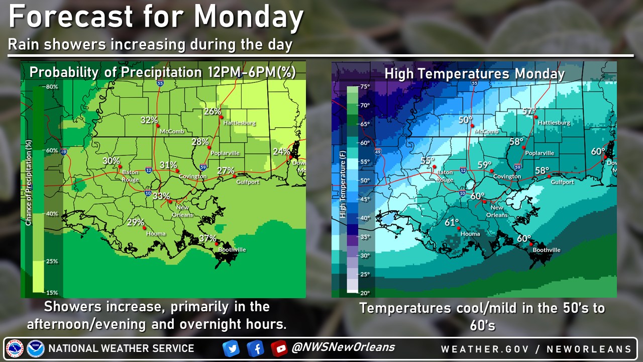
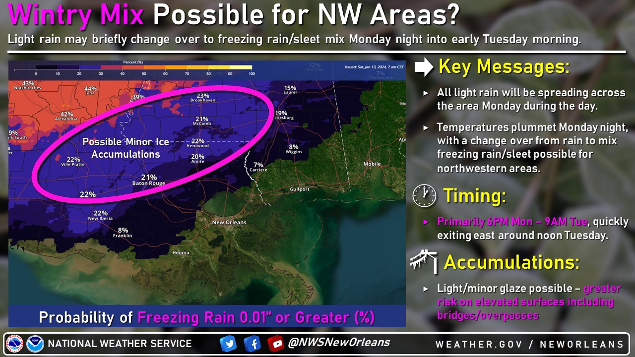
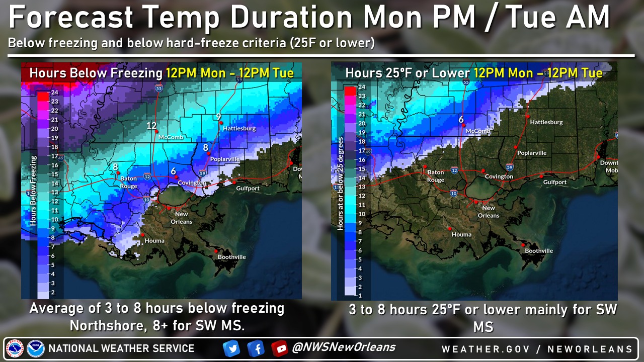
Starting with Monday, showers increase during the day thru overnight hours. Cold air will be diving south which may lead to a brief changeover to sleet/freezing rain for NW areas overnight. Some light accumulations possible, mainly for elevated surfaces.
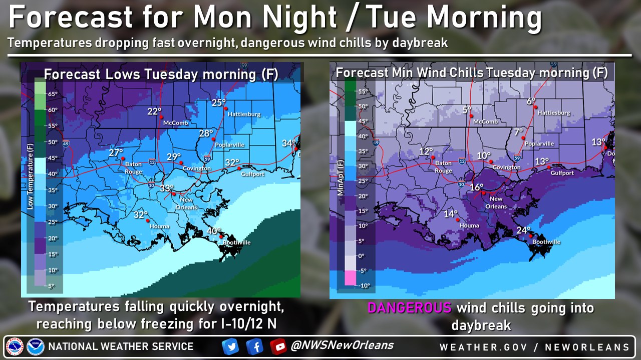
Otherwise, temperatures will be plummeting overnight Monday night into daybreak Tuesday with DANGEROUS wind chills in the teens to single digits starting off the day Tuesday.
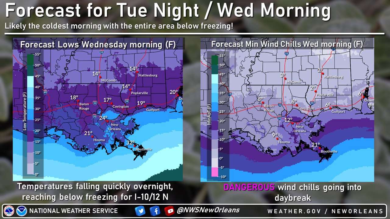
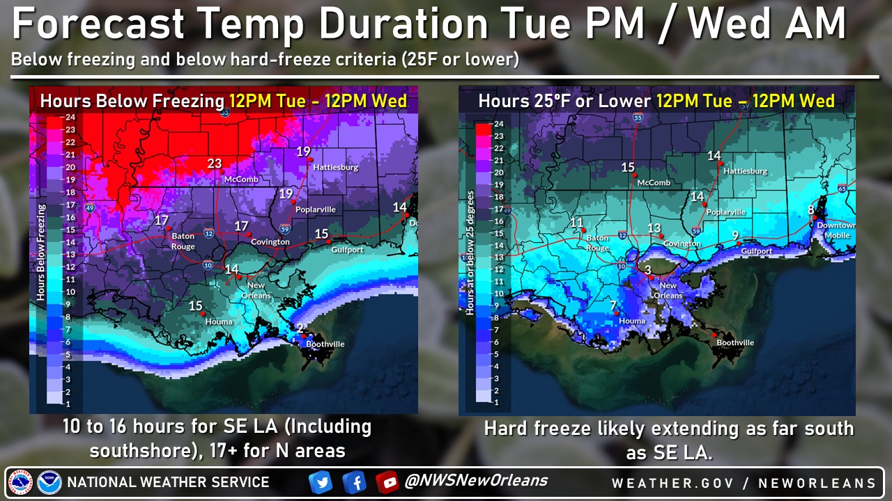
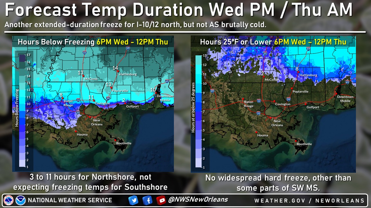
It’ll be a frigid, cold day on Tuesday with highs generally in the 30s and wind chills staying in the 20s. The coldest night is looking like Tue night/Wed morning with almost the entire area below freezing for an extended period. Hard freeze to the Southshore.
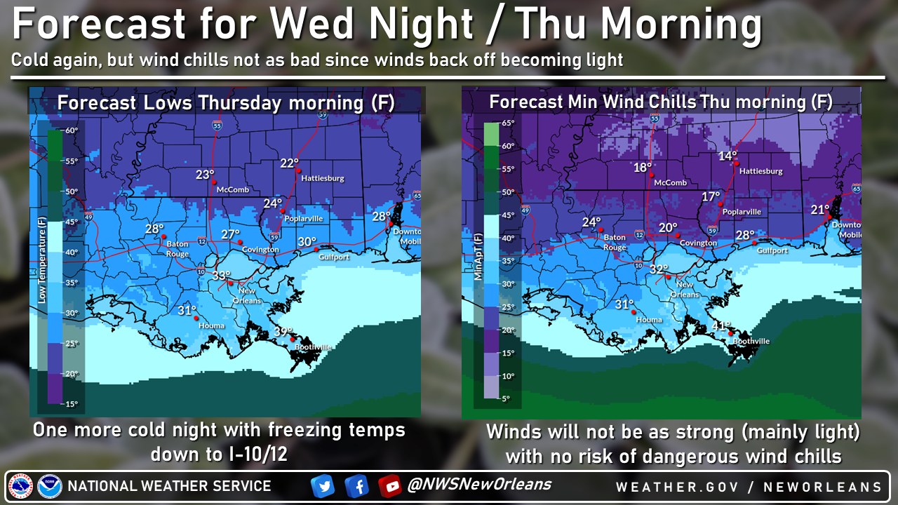
Highs “warm” back to the 40’s Wednesday, but one more cold night Wed night/Thurs morning with another extended duration freeze for I-10/12 on north. Close to freezing across the Southshore in the low to mid 30’s.
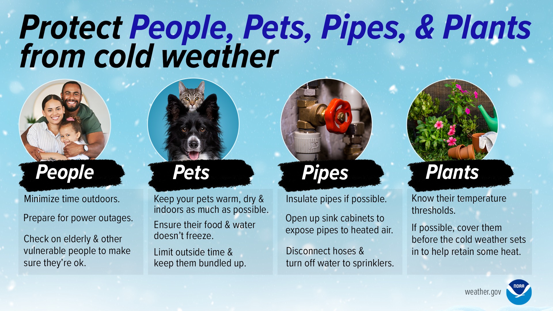
NOW is a great time to ensure you have all necessary precautions ready to go. Remember the 4 P’s of cold weather safety: People, Plants, Pets, Pipes

Related posts

May 8, 2024