
Diocese of Houma-Thibodaux cancels school for tomorrow
January 15, 2024
Nicholls delays opening of University until 9am on Tuesday; Fletcher will close all campuses
January 15, 2024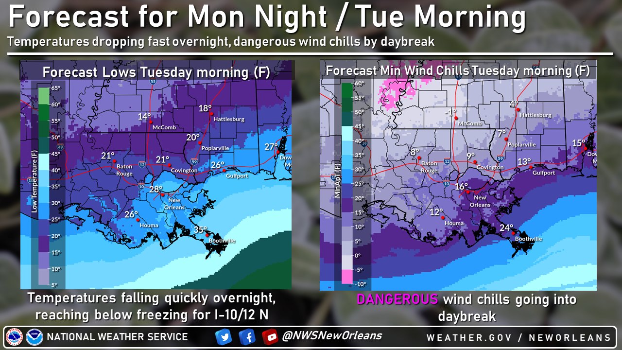
From the National Weather Service:
2:30PM 1/15/24:
Changes from Previous Update:
• No changes in hazards and forecast confidence from this morning.
• Freeze warning added for SE LA and portions of coastal MS tonight into early Tuesday.
• Hard Freeze warning tonight expanded south along Atchafalaya Basin tonight into early Tuesday.
• Wind Chill Advisory expanded in area tonight/early Tuesday south across the Atchafalaya Basin to portions of the Southshore.
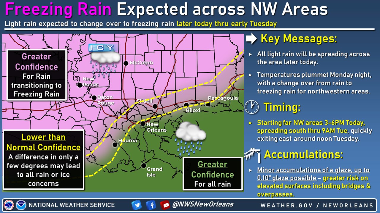
Light freezing rain is still expected to develop by this evening and linger through the night, primarily for northwestern areas, where a glaze of ice to around 0.10″ will be possible, leading to impacts mainly across elevated roadways/bridges. Timing: This evening into early Tue.
Outside of the risk of freezing rain will be the bitter cold wind chills by daybreak Tuesday. A Wind Chill Advisory is in effect for all areas except the Southshore and coastal Louisiana due to wind chills in the teens to even single digits!
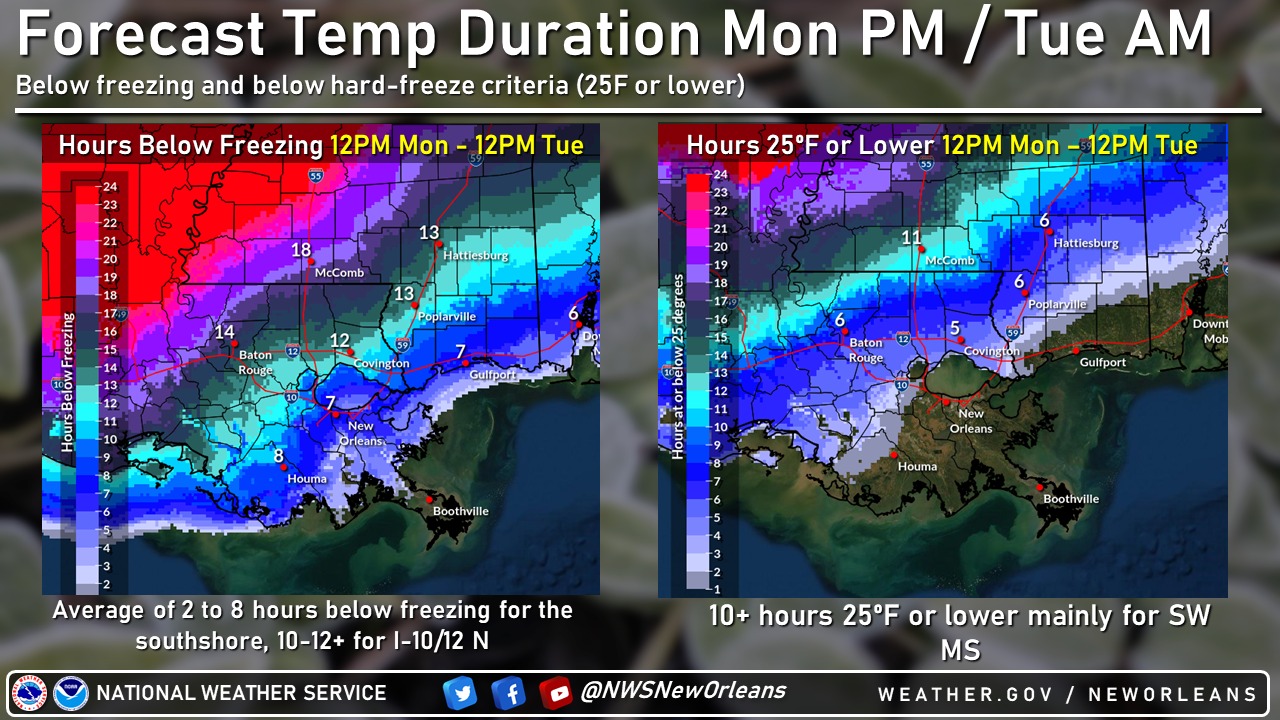
It’ll be Tuesday night into Wednesday morning where we will see the coldest morning with brutally cold wind chills overnight. Single digit wind chills down to near the I-10/12 corridor and most of the entire area below freezing.
NOW is a great time to ensure you have all necessary precautions ready to go. Remember the 4 P’s of cold weather safety: People, Plants, Pets, Pipes
Be sure to check back for the latest forecast updates.

Related posts

May 8, 2024