
Terrebonne Booking Log: 02/12/2021
February 12, 2021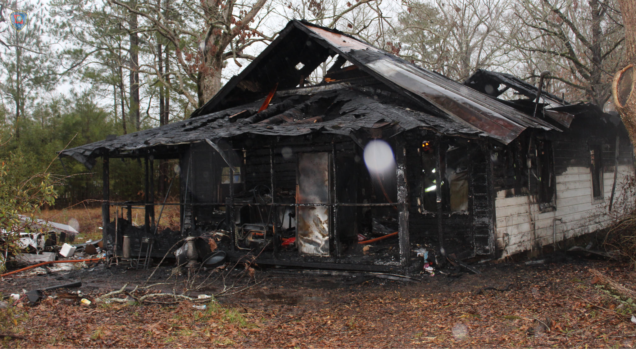
Fatal house fire prompts safe heating tips from State Fire Marshal
February 13, 2021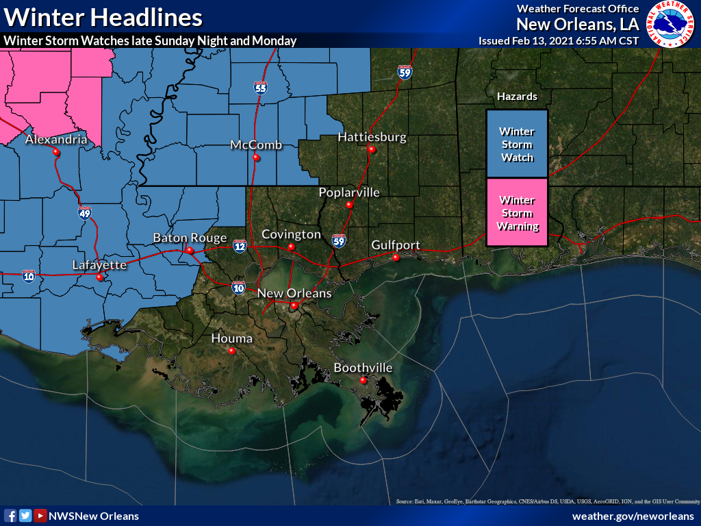
It’s time to break out the winter weather gear! Our forecast is current call for temps in the teens to 20s Monday night into Tuesday morning.

While snow is not in the forecast this far south, a Winter Storm Watch and Winter Storm Warnings have been issued for pretty much the entire state, except for our little southeastern corner.
As time passes and the forecast becomes more certain, we are seeing the line of the Winter Storm Watch inch closer to the Houma and even north Thibodaux area.
Within the Winter Storm areas, freezing rain and sleet are expected to develop late Sunday night and continue through much of the day on Monday before diminishing. Ice accumulations of one quarter inch or more are possible in the watch area. Travel in the watch area could become very difficult, if not impossible, at some point late Sunday night or Monday.
In addition, much colder air will move into south Mississippi and southeast Louisiana behind the storm. Overnight lows Monday night into Tuesday morning will fall into the teens to lower 20s across the north half of the area, and mid to upper 20s across most of the south. These will be the coldest temperatures this winter and in the last few years. The current forecast low temperatures for Tuesday morning are likely to break records for the date by 5 degrees or more in many areas. These temperatures are also likely to cause any precipitation that doesn’t dry Monday evening to freeze on surfaces such as roadways, driveways and sidewalks.
Remember to protect the 4 P’s (people, pets, plants and pipes), especially Monday night into Tuesday morning.

