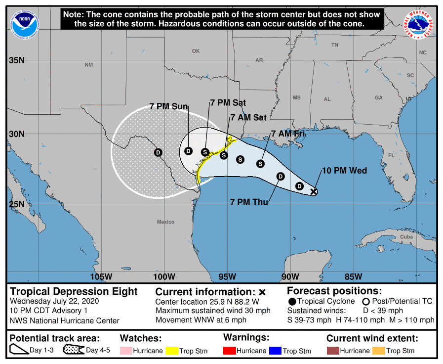
Tropical Depression 8 forms in the Gulf of Mexico
July 22, 2020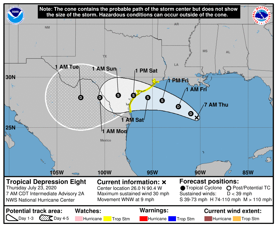
TD 8 continues its journey west to Texas; rain expected in Louisiana through Monday
July 23, 2020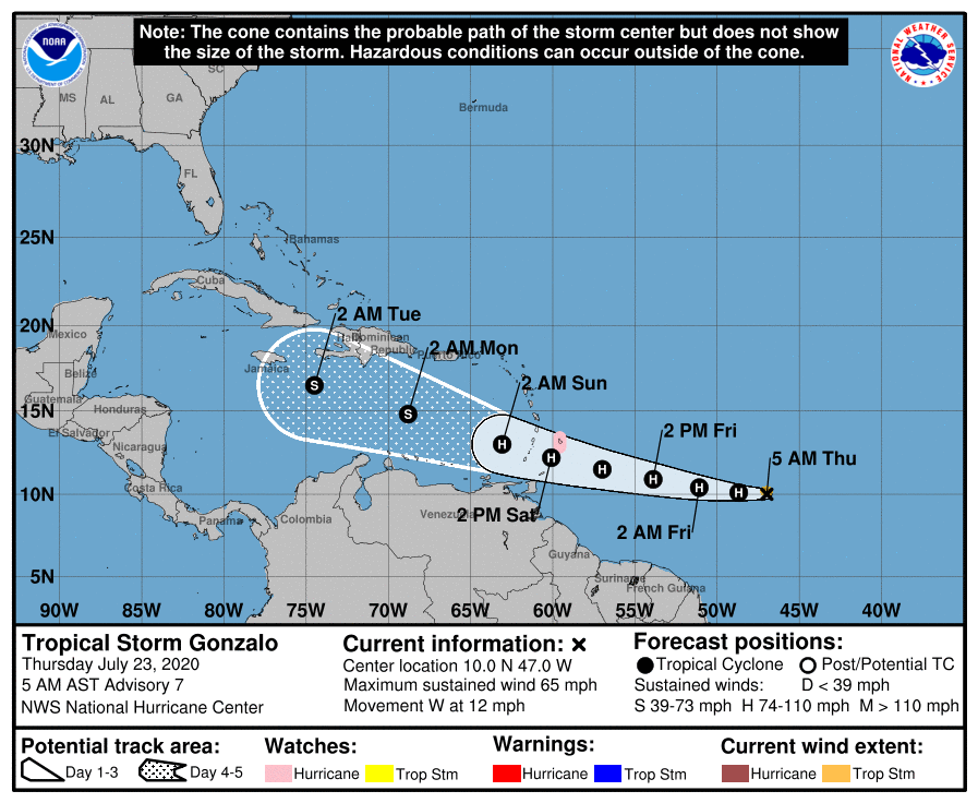
From the National Hurricane Center:
At 5 a.m. AST, the center of Tropical Storm Gonzalo was located over the Atlantic Ocean about 970 miles (1565 km) east of the southern Windward Islands. It’s moving toward the west near 12 mph (19 km/h). On the forecast track, the center of Gonzalo would approach the Windward Islands late Friday and Saturday.
A Hurricane Watch is in effect for Barbados – hurricane conditions are possible there. Interests in the southern Windward Islands should monitor the progress of Gonzalo and follow any advice given by local officials. There is an increasing risk of wind and rain impacts from Gonzalo in portions of the southern Windward Islands this weekend. Additional watches or warnings will likely be required for some of these islands later today. For storm information specific to your area, please monitor products issued by your national meteorological service.
Maximum sustained winds have increased to near 65 mph (100 km/h) with higher gusts. Tropical-storm-force winds extend outward up to 35 miles (55 km) from the center. Further strengthening is forecast to occur during the next couple of days, and Gonzalo is expected to become a hurricane later today.
The next complete advisory will be issued by NHC at 11 a.m. AST with an intermediate advisory at 8 a.m. AST.

