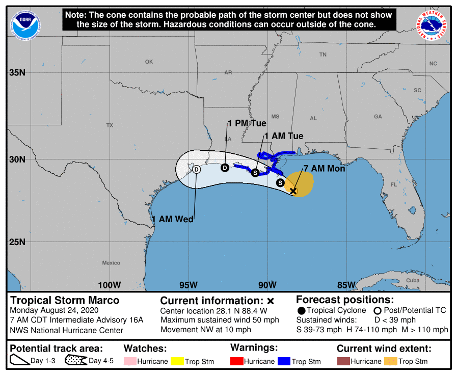
Marco delivering severe weather along the Gulf coast
August 24, 2020
Two Unrestrained Passengers Die in Crash After High-Speed Chase
August 24, 2020
Tropical Storm Laura is now the focus for our area. The cone continues to shift from east to west with each update. A Hurricane Watch will likely be required for portions of the U.S. northwest Gulf coast area by this evening.
At 8 a.m. EDT, the center of Tropical Storm Laura was located about 205 miles (330 km) east-southeast of the Isle of Youth. It’s moving toward the northwest is forecast by Wednesday. On the forecast track, the center of Laura will move over the Caribbean Sea just offshore the southern coast of Cuba today, into the southeastern Gulf of Mexico by early Tuesday morning, and then move over the central and northwestern Gulf of Mexico Tuesday night and Wednesday.

Maximum sustained winds are near 65 mph (100 km/h) with higher gusts. Tropical-storm-force winds extend outward up to 175 miles (280 km) from the center. Gradual strengthening is expected, and Laura is forecast to become a hurricane by early Tuesday.
From late Wednesday into Friday, Laura is expected to produce rainfall of 5 to 10 inches, with isolated maximum amounts of 15 inches across portions of the west-central U.S. Gulf Coast near the Texas and Louisiana border north into portions of the lower Mississippi Valley.

