
Man wanted in Terrebonne business disturbance
June 10, 2022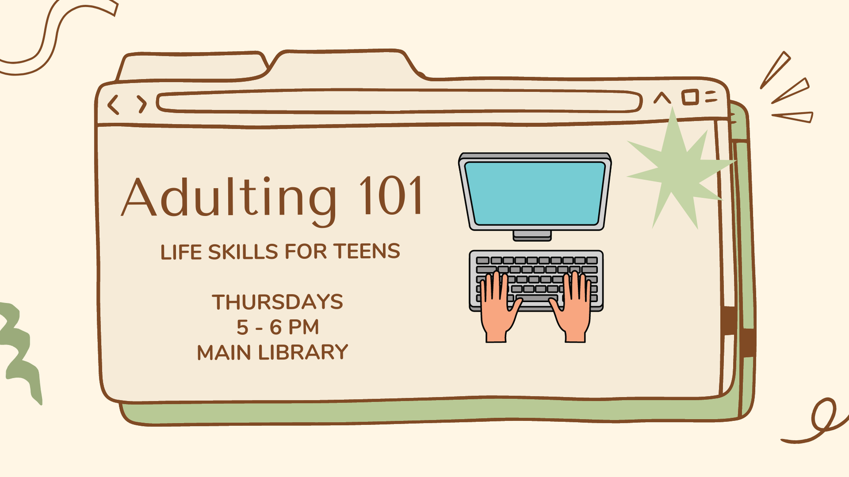
TPL Teaches Young Adults Life Skills at Adulting 101 Workshop
June 10, 2022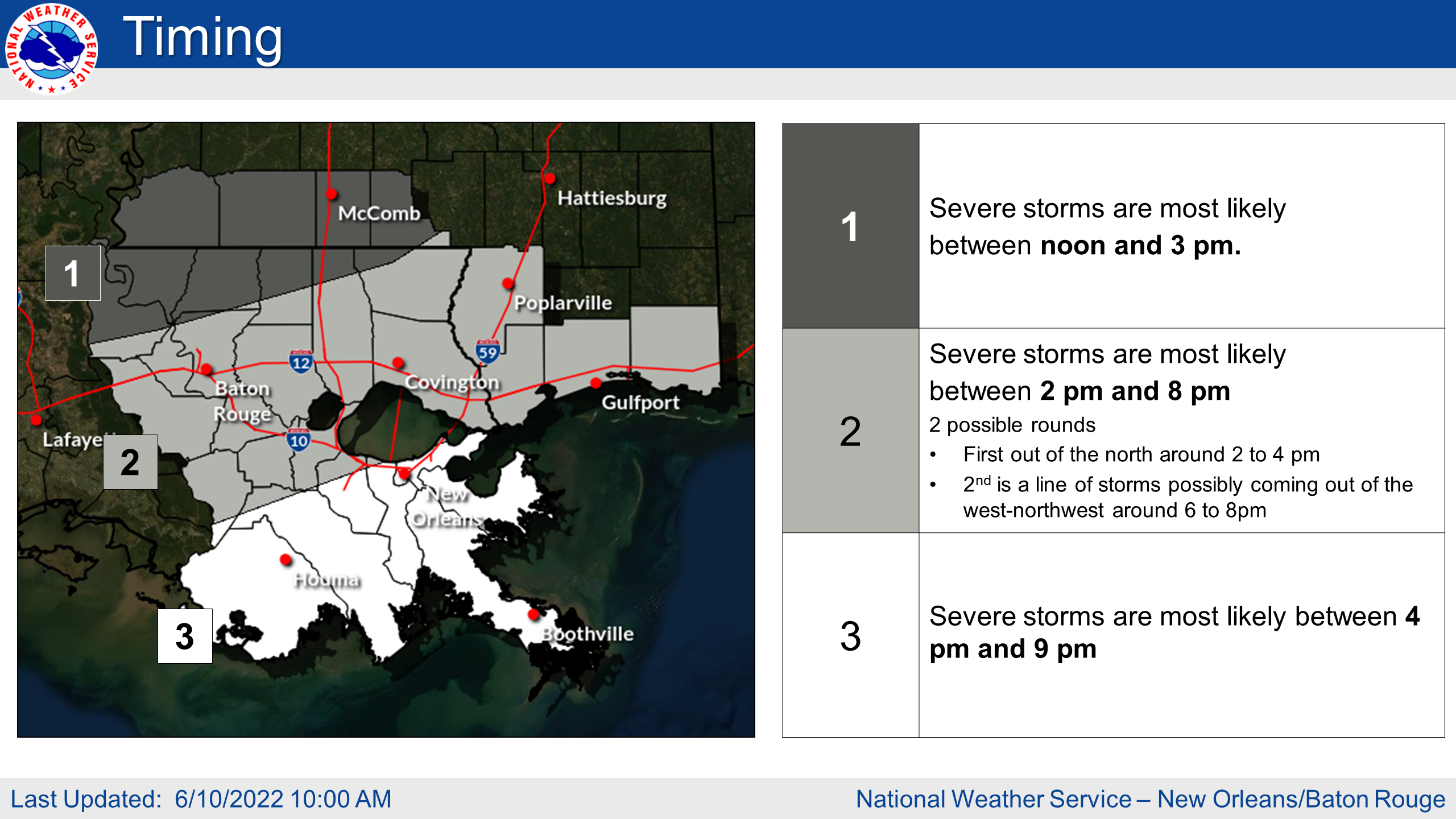
There is now an ENHANCED RISK of Severe Weather late this afternoon through this evening. Highest threat will likely be between 3pm and 6pm for areas north of I-12 in Southwest Mississippi and Southeast Louisiana. Highest threat will likely be between 5pm and 8pm for areas along the I-10/12 corridor including Coastal Mississippi, Metro New Orleans, and Metro Baton Rouge. Highest threat will likely be between 7pm and 10pm for Coastal Louisiana.

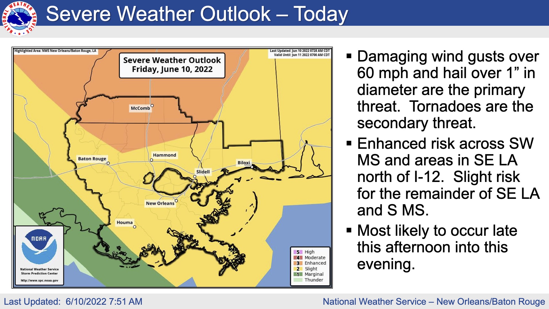
We are confident that storms will impact the area today and that a few of these storms will turn severe. The main
threats associated with any severe storms will be:
Damaging Winds: Wind gusts greater than 60 mph will be possible. Trees and powerlines could be damaged and lead
to isolated/scattered power outages
Large Hail: Large hail up to 1.5 inches in diameter will be possible. Wind blown hail could cause additional damage

Tornadoes: A few tornadoes will be possible
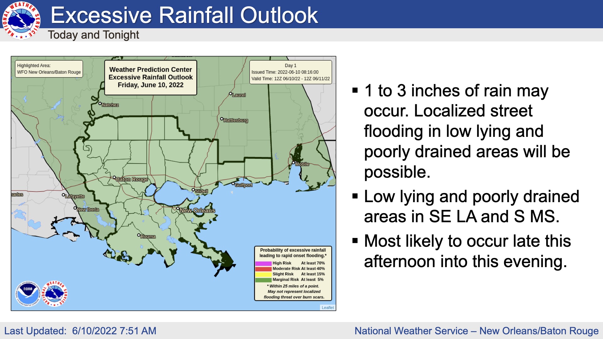
Rainfall: In addition to the severe weather threat, rainfall of 1 to 3 inches is forecast with locally higher amounts possible. This rainfall could lead to ponding of water in low lying areas and areas of poor drainage.

