Terrebonne Parish Animal Shelter lowers adoption fees for ‘Clear the Shelters’ campaign
August 24, 2021
Craig Donald Guidry
August 25, 2021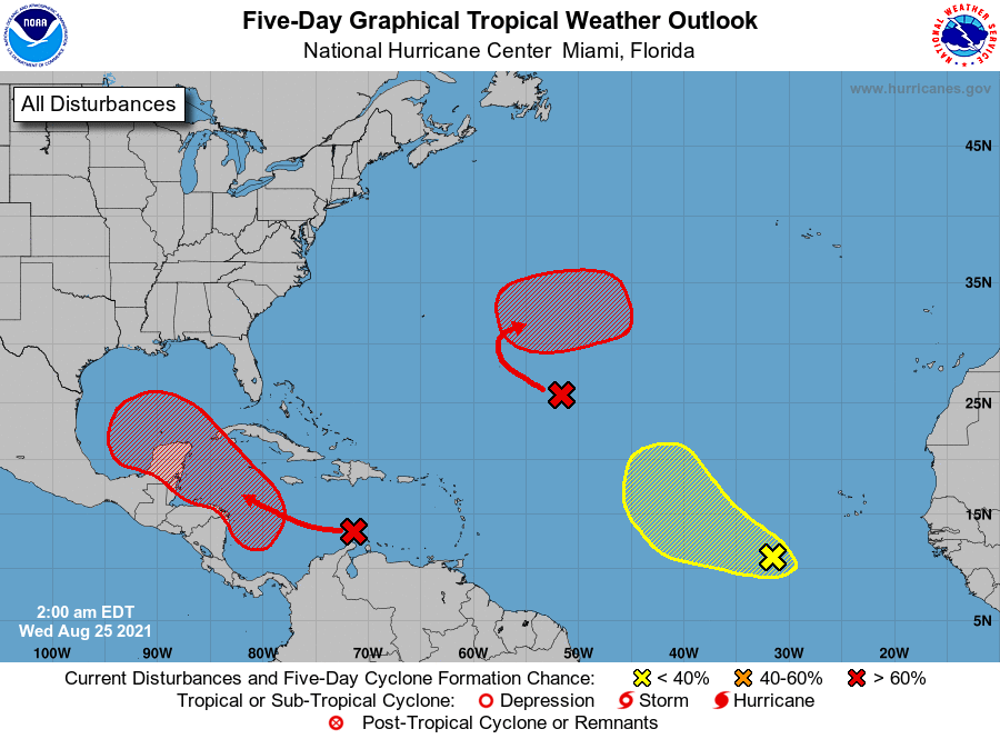
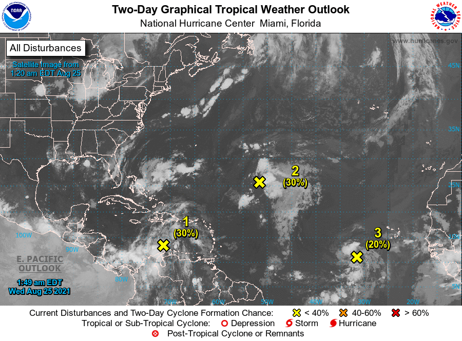
The Atlantic is playing host to a party of three this week. One, Invest 99, is of concern as it eyes the Gulf of Mexico. The NHC is saying this will likely become a depression by Friday or Saturday as it approaches the Caribbean.
From the NHC:
1. A broad area of low pressure is expected to form over the western Caribbean Sea in a couple of days from a tropical wave currently located over the central Caribbean Sea. Environmental conditions are forecast to be conducive for development, and a tropical depression is likely to form late this week or this weekend while the system moves northwestward over the northwestern Caribbean Sea, near or across the Yucatan Peninsula of Mexico, and into the western Gulf of Mexico by Sunday. Formation chance through 48 hours is low at 30 percent. Formation chance through 5 days is high at 70 percent.

2. A broad trough of low pressure is producing disorganized showers and thunderstorms over the central tropical Atlantic about 1000 miles northeast of the northern Leeward Islands. Only slow development of this system is expected during the next day or so due to unfavorable upper-level winds. Afterwards, environmental conditions are expected to become more conducive for development, and a tropical depression is likely to form late this week or this weekend while the system turns eastward over the central Atlantic. Formation chance through 48 hours is low at 30 percent. Formation chance through 5 days is high at 70 percent.
3. A tropical wave over the far eastern tropical Atlantic located several hundred miles southwest of the Cabo Verde Islands is producing a disorganized area of showers and thunderstorms. Some development of this system is possible over the next several days while it moves west-northwestward at 10 to 15 mph over the eastern tropical Atlantic. Upper-level winds are forecast to become less conducive for development by this weekend. Formation chance through 48 hours is low at 20 percent. Formation chance through 5 days is low at 30 percent.