Robert David "Speck" Gros
January 13, 2009Downtown Art Gallery (Houma)
January 15, 2009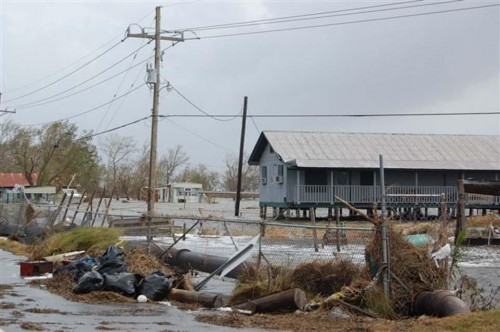
Lafourche Parish residents will get an opportunity to view the newly revised Preliminary Digital Flood Insurance Rate Maps (DFIRMS) at an open house today.

The maps will be on display from 2 to 8 p.m. at the Lafourche Parish Government office in the old Wal-Mart building, 4876 Highway 1 in Mathews.
Lafourche Parish President Charlotte Randolph and DFIRM specialists will be on hand to answer questions and provide additional information about the flood mapping process, the impact of the new flood maps and the benefits and requirements of flood insurance. All residents are encouraged to attend.

The Federal Emergency Management Agency (FEMA) administers the National Flood Insurance Program, which designed the Flood Insurance Rate Maps.
According to FEMA officials, the maps delineate flood-risk zones and serve a key role in the defense against flood losses on an individual, community, state and national basis.
The new maps will allow community planners, local officials, engineers, builders and others to have the tools to make important determinations about where and how new structures and developments should be built to maximize safety.

The DFIRMs will replace the current maps, which are outdated and were produced using earlier technology, officials say. The new maps have a digital format that provide greater detail and make it easier for residents to view the information.
Officials believe the new flood maps will help residents and business owners understand their current flood risks and help to make more informed decisions about protecting their property.
The release of the DFIRMs begins a process of official and public review and comments, ultimately resulting in the adoption of the new digital flood maps, FEMA officials say.
However, Randolph has asked the Louisiana Recovery Authority to petition Gov. Bobby Jindal to allow Lafourche Parish to use the Advisory Base Flood Elevations Maps (ABFEs), which were adopted by the parish in 2007, instead of the new DFIRMs.
“We want to use the ABFEs until a better analysis can be done on the new DFIRMs,” Randolph said. “We have discovered that some of the figures are wrong just like so many other parishes have. We don’t want to adopt something that has the wrong information for our parish.”
“Not to mention, the new DFIRMs do not certify the South Lafourche Levee System. We need that levee to be certified,” she said.
The Lafourche Parish Government has 90 days to decide whether to adopt the new DFIRMs. Randolph is presently awaiting a response from state officials on whether the parish can use the ABFEs in their place.
While adoption is voluntary, FEMA said it is a requirement for participation in the National Flood Insurance Program.
Concerned residents should consult their local floodplain administrator with questions on what flood map or elevations to use during the rebuilding process for hurricanes Gustav and Ike.
Homeowners in low-lying areas such as Golden Meadow are waiting to see what affect FEMA flood maps will have on future insurance rates and development requirements. * File photoTri-Parish Times

