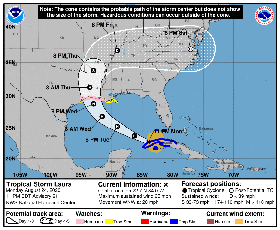
TS Laura moves into Gulf of Mexico; forecast to become a hurricane Tuesday
August 24, 2020
Laura becomes a Hurricane
August 25, 2020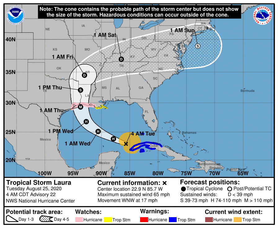
Terrebonne and Lafourche remain under a Tropical Storm Watch this morning as TS Laura continues to approach the Louisiana/Texas coastline. Laura is now forecast to be a major storm, expected to make landfall as a Category 3 storm in southwest Louisiana.

At 4 a.m. CDT, the center of Tropical Storm Laura was located about 85 miles (140 km) northwest of the western tip of Cuba and about 680 miles (1095 km) southeast of Lake Charles, Lousiana. It’s moving toward the west-northwest near 17 mph (28 km/h). This general motion should continue today. A turn toward the northwest is forecast by Wednesday, and a northwestward to north-northwestward motion should continue through Wednesday night. On the forecast track, the center of Laura will move away from Cuba and over the southeastern Gulf of Mexico this morning, move over the central and northwestern Gulf of Mexico tonight and Wednesday, approach the Upper Texas and Southwest Louisiana coasts on Wednesday night and move inland near those area on Thursday.
Maximum sustained winds remain 65 mph (100 km/h) with higher gusts. Tropical-storm-force winds extend outward up to 175 miles (280 km) from the center. Significant strengthening is forecast during the next 48 hours, and Laura is now expected to be a major hurricane at landfall.
The combination of a dangerous storm surge and the tide will cause normally dry areas near the coast to be flooded by rising waters moving inland from the shoreline. The water could reach the following heights above ground somewhere in the indicated areas if the peak surge occurs at the time of high tide…
– High Island TX to Morgan City LA including Sabine Lake, Calcasieu Lake, and Vermilion Bay…7-11 ft
– Morgan City LA to Mouth of the Mississippi River…4-6 ft
– Mouth of the Mississippi River to Ocean Springs MS including Lake Borgne…3-5 ft
– Lake Pontchartrain and Lake Maurepas…2-4 ft

From Wednesday afternoon into Saturday, Laura is expected to produce rainfall of 4 to 8 inches, with isolated maximum amounts of 12 inches across portions of the west-central U.S. Gulf Coast near the Texas and Louisiana border north into portions of the lower Mississippi Valley. This rainfall could cause widespread flash and urban flooding, small streams to overflow their banks, and minor to isolated moderate river flooding.
The next complete advisory will be issued by NHC at 10 a.m. CDT with an intermediate advisory at 7 a.m. CDT
