
Grand Isle Port Commission Awards Contract for Historical Repair Project
November 20, 2023
Southdown Plantation and Museum announces first Christmas Winter Wonderland
November 20, 2023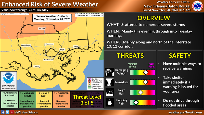
Here is an update from the National Weather Service in New Orleans concerning the severe weather threat later today through tonight.
Overview:
WHAT: SLIGHT to ENHANCED RISK of Severe Weather
WHEN: Late today into Tuesday morning.
WHERE: All of Southeast LA and Southern MS.
CONFIDENCE:
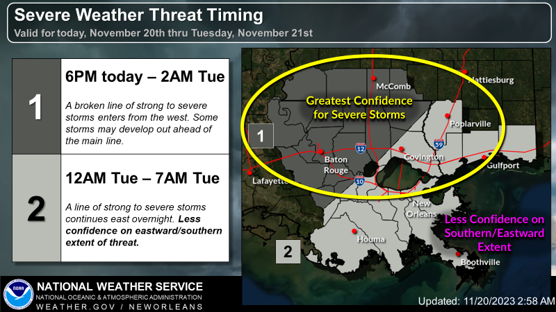
Confidence continues to increase that severe thunderstorms will impact portions of Southeast Louisiana and Southern Mississippi, especially along and north of the I-10/12 corridor.
Confidence in timing is slightly lower, with storms possibly entering our western areas as early this evening then progressing east thru early Tuesday morning.
Impacts:
The main threats associated with any severe storms will be:
• Wind gusts greater than 60 mph
• A few tornadoes, some strong possible in the Enhanced risk area.
• Large hail.
In addition to the severe weather threat, rainfall of 1 to 2 inches is forecast with locally higher amounts possible.
This rainfall could lead to ponding of water in low lying areas and areas of poor drainage.

Related posts

May 8, 2024