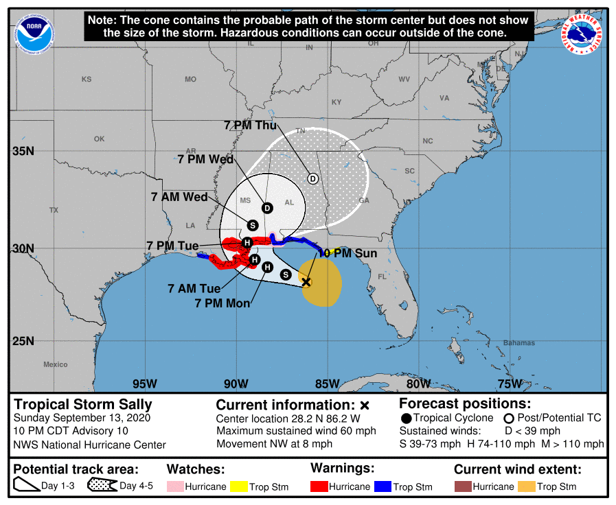
Sally shifts to the east; area still under Hurricane Warning
September 13, 2020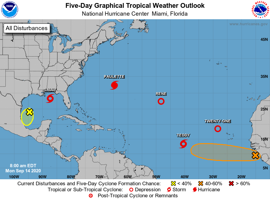
Elsewhere in the Atlantic: Five tropical cyclones ties record from 1971
September 14, 2020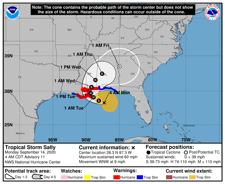
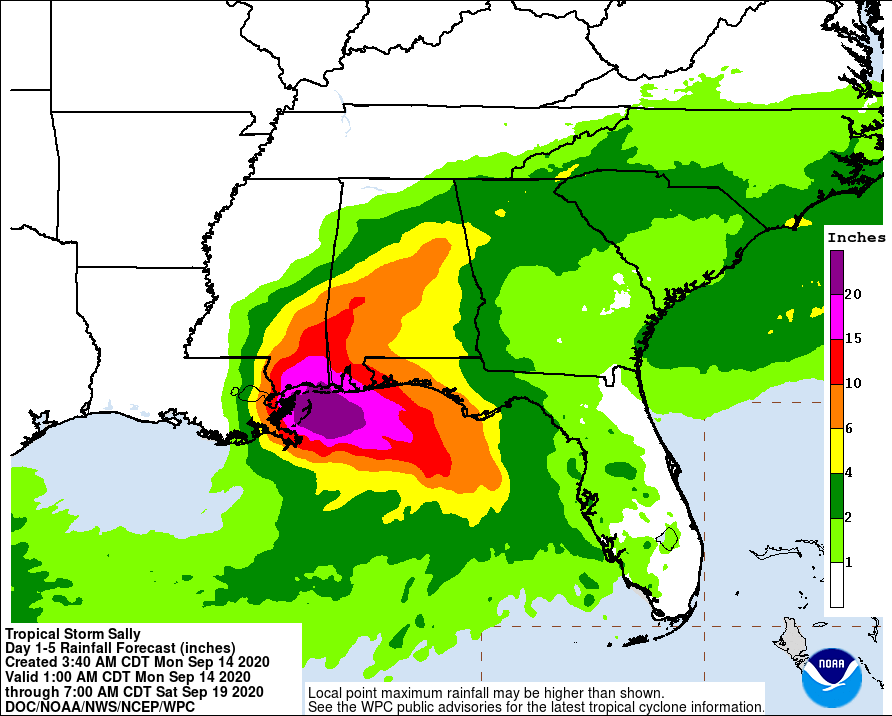
The biggest change at the 4am update is landfall now forecast to be near the Louisiana/Mississippi state line. Terrebonne and Lafourche are still under a hurricane warning. However, Terrebonne is now completely outside the “cone of uncertainty”.
At 400 AM CDT (0900 UTC), the center of Tropical Storm Sally was located near latitude 28.3 North, longitude 87.3 West. Sally is moving toward the west-northwest near 9 mph (15 km/h). This general motion is expected today, followed by a decrease in forward speed and a turn to the northwest tonight and a northward turn sometime on Tuesday. On the forecast track, the center of Sally will move over the north-central Gulf of Mexico today, and approach southeastern Louisiana this afternoon, and make landfall in the hurricane warning area on Tuesday. Afterward, Sally is expected to move slowly north-northeastward near the northern Gulf Coast through Wednesday.

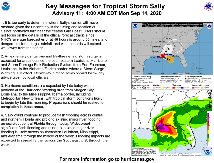
Maximum sustained winds are near 60 mph (95 km/h) with higher gusts. Strengthening is expected over the next day or so, and Sally is forecast to become a hurricane by tonight, with additional
strengthening possible before the center crosses the northern Gulf Coast.
Tropical-storm-force winds extend outward up to 125 miles (205 km) from the center. The estimated minimum central pressure based on data from the NOAA Hurricane Hunters is 996 mb (29.42 inches).

