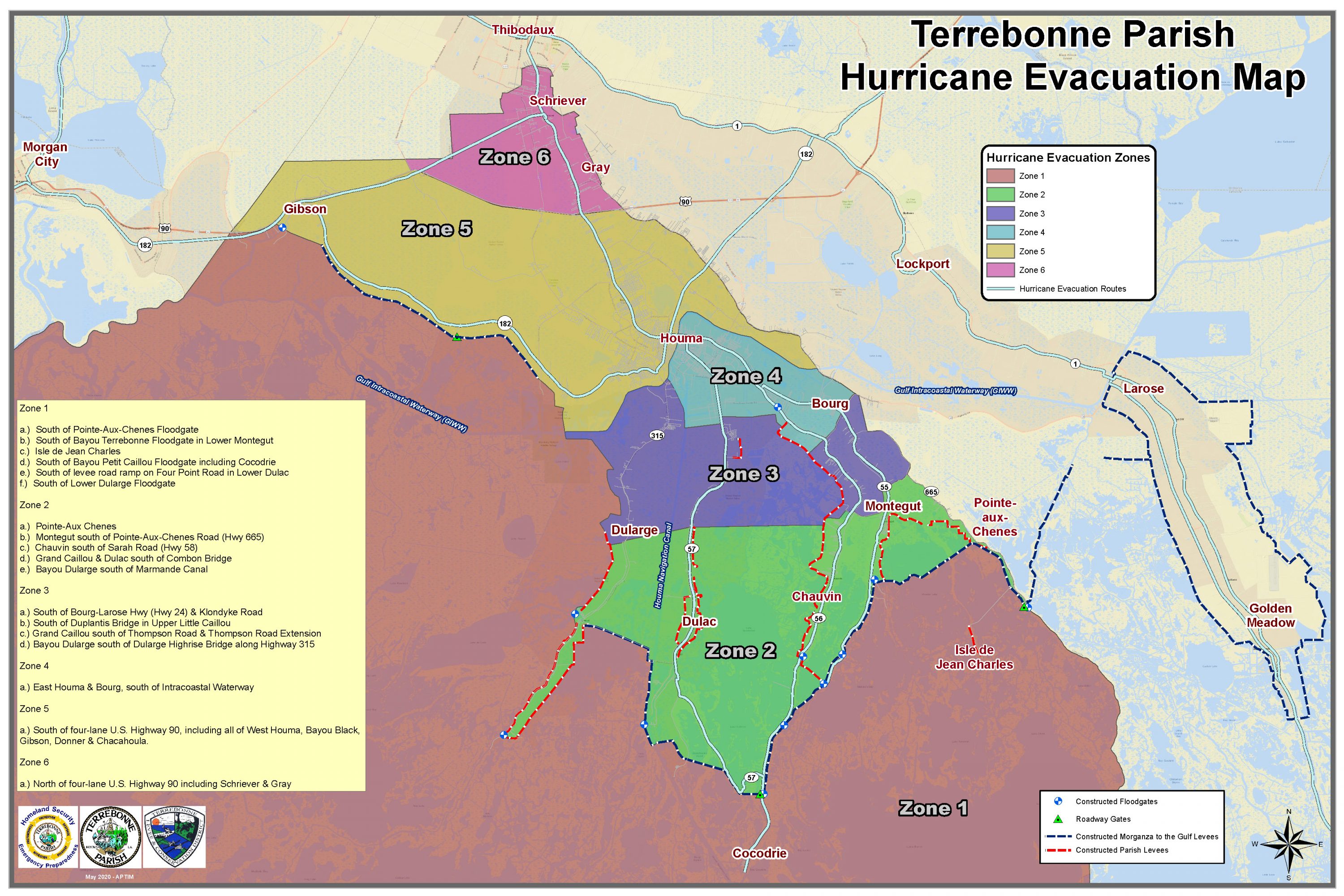
Terrebonne Evacuation Map: What zone do I live in?
August 23, 2020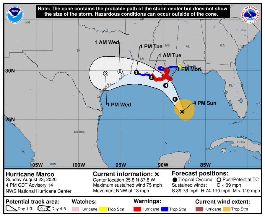
Hurricane Marco’s track shifts; looks to bring life-threatening surge along the coast
August 23, 2020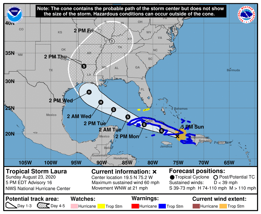
An Air Force Hurricane Hunter aircraft finds that Laura has increased in intensity. It is forecast to make landfall near the Texas/Louisiana border, as possibly a Category 2 storm.
At 500 PM EDT (2100 UTC), the center of Tropical Storm Laura was located near latitude 19.5 North, longitude 75.2 West. Laura is moving toward the west-northwest near 21 mph (33 km/h), and this
general motion with some decrease in forward speed is expected over the next couple of days. A turn toward the northwest is forecast by Wednesday. On the forecast track, the center of Laura will move
near or over southern coast Cuba tonight and Monday, and move over the southeastern Gulf of Mexico Monday night and Tuesday. Laura is expected to move over the central and northwestern Gulf of Mexico Tuesday night and Wednesday.


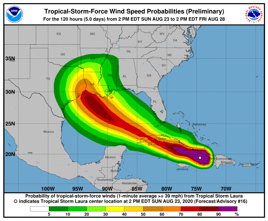
Data from an Air Force Reserve reconnaissance aircraft indicate that the maximum sustained winds are near 60 mph (95 km/h) with higher gusts. Little change in strength is forecast while Laura moves near the southern coast of Cuba tonight. However, strengthening is forecast after the storm moves over the Gulf of Mexico, and Laura is forecast to become a hurricane late Tuesday or Tuesday night.
Tropical-storm-force winds extend outward up to 140 miles (220 km) from the center. The minimum central pressure estimated from reconnaissance aircraft data is 1000 mb (29.53 inches).

