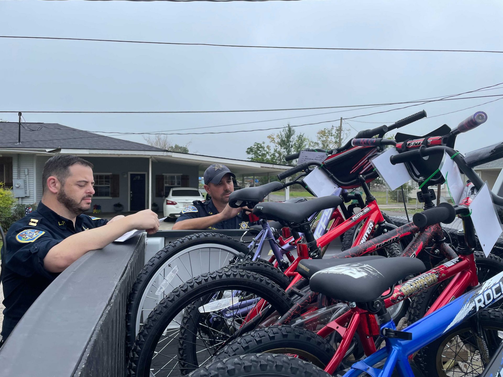
LPSO delivers 130 Bicycles for 28th Annual Bike Give-Away
December 19, 2021
Milton Anthony Picou, Sr.
December 20, 2021By Heather Kirk-Ballard, LSU AgCenter Horticulturist
One of the most important factors that influences a garden’s success is the weather.
Temperatures have a major impact on the growth and survival of our plants. Preparing gardens for various weather conditions is both a discipline and an art — and there are many tools out there to help you get ready.
The Old Farmer’s Almanac has predicted Louisiana will experience a colder-than-normal winter this year. The publication says to expect the coldest periods in mid-December, mid- to late January and early to mid-February.
The Old Farmer’s Almanac is one of North America’s oldest continuously published periodicals and reference guides, with the first issue being published in 1792. Farmers and home gardeners have been using it for hundreds of years.
An almanac is defined as records that predict astronomical events such as sun phases, tides and the weather with respect to the time of year. Most notable for gardeners is the almanac’s weather forecasts.
In addition to these forecasts, another useful tool for gardeners is the U.S. Department of Agriculture’s hardiness zones maps. These types of maps got a much later start than the almanac. Their history begins in the early 1900s.
The first hardiness zones maps were created by Alfred Rehder in 1927 at the Arnold Arboretum of Harvard University in Boston, Massachusetts. This U.S. map with eight hardiness zones was based on a survey of plants and their survivability in climatic regions across the country.
Donald Wyman later updated the map in 1938 using U.S. Weather Bureau data collected from 1895 to 1935. The USDA published its first map in 1960 based on data from 450 weather stations around the country. It has been updated over the years and today features 13 zones, which are further broken down into “a” and “b” subzones. Louisiana falls into zones 8a, 8b, 9a and 9b.
Across the U.S., weather varies greatly. Within our yards and gardens, there is even further variation, just on a finer scale — what horticulturists and gardeners refer to as microclimates. A microclimate is defined as the climate of a small area that differs from that of the general surrounding region.
Microclimate can occur in small areas such as corners of the house, or they can be as large as an entire city. In urban areas, there can be a “heat island” effect where paved surfaces, buildings and structures limit the cooling of the night air. Asphalt, concrete, bricks and other building materials absorb the sun’s heating rays and radiate it during the night. Suburban areas also can experience this phenomenon.
Large-scale microclimates also can be created by bodies of water and by elevation. Here in Louisiana, the latter is not as much of a concern. With every 1,000 feet of change in elevation, temperatures decrease an average of 3.5 degrees Fahrenheit.
Now water is a different story here in Louisiana — because we’ve got plenty of it. Water cools and warms slower than land and therefore helps moderate temperatures. Plants near water do not get as hot during the day or as cold during the night.
Microclimates occur on a small scale in our yards, too. Paved surfaces such as patios, walkways, driveways and pool decks as well as brick surfaces of buildings absorb heat during the day and emit the radiant heat at night, creating microclimates that can benefit plants during cold winter weather. Even tiny topographic changes within your yard or garden can create small microclimates, with low spots being cooler and more prone to frosts.
We can use these microclimates to our advantage when designing and creating our landscapes and gardens. Taking advantage of the position of the sunlight in the yard or landscape is very important when considering where to place a plant and its future success.
The solar energy from the sun creates heat that affects both the air and soil temperatures. The direction of the sun and the slope of the land determines how much solar energy, or heat, reaches the ground.
For example, an east-facing garden will get morning sunlight and will be cooler than a west-facing garden that will receive stronger solar rays in the later part of the day. A south-facing area or slope will receive the most amount of sunlight, and full-sun plants will be most productive there. This includes fruits, vegetables and many flowering plants. North-facing areas will get less solar energy and will be relatively colder and wetter. South-facing slopes will be warmer and drier.
Figuring out what microclimates exist in your yard or garden also will help you identify shady spots. Areas will be shaded longest when the sun is low in the sky. This also will affect the temperature of the soil.
In the wintertime, you can help protect cold-sensitive plants such as citrus and tropicals by using sheets, plastic or frost covering to trap the heat that radiates up from the ground. Cover trees in the daytime all the way down to the ground. Prevent the material from touching leaves with tall stakes.


