
Gov: 14-year-old girl first fatality from Hurricane Laura
August 27, 2020
BREAKING: Reported chemical plant fire near Lake Charles
August 27, 2020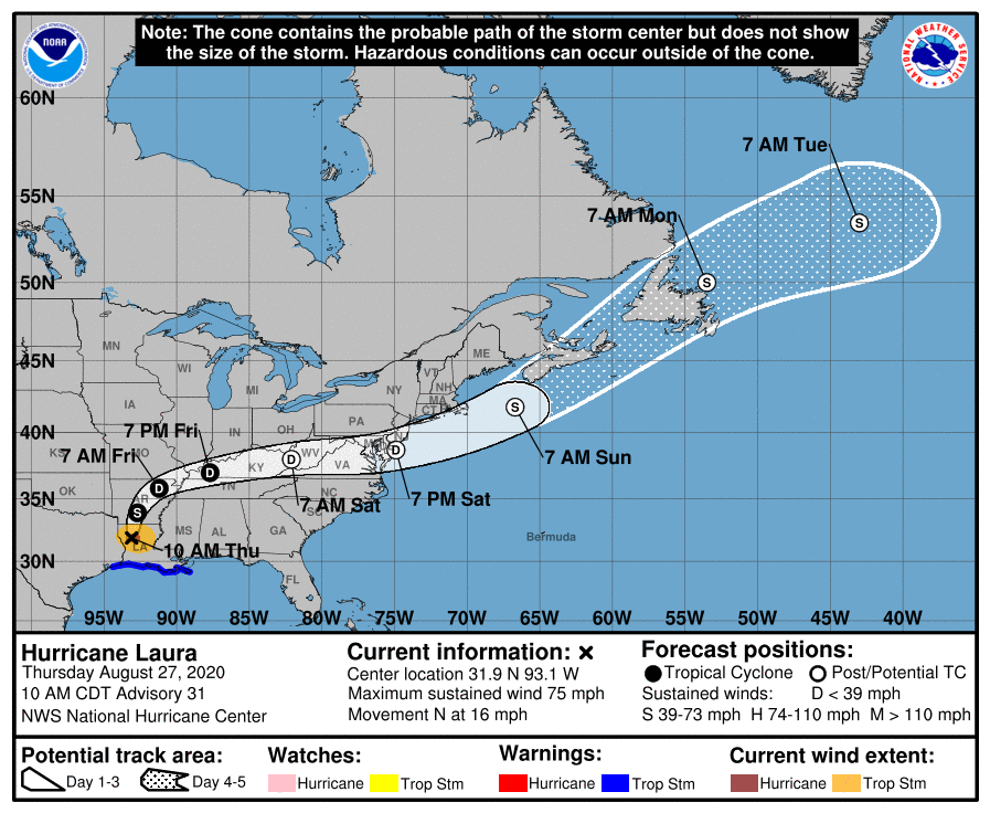
At the 10 a.m. update, Laura is located about 55 miles southeast of Shreveport.
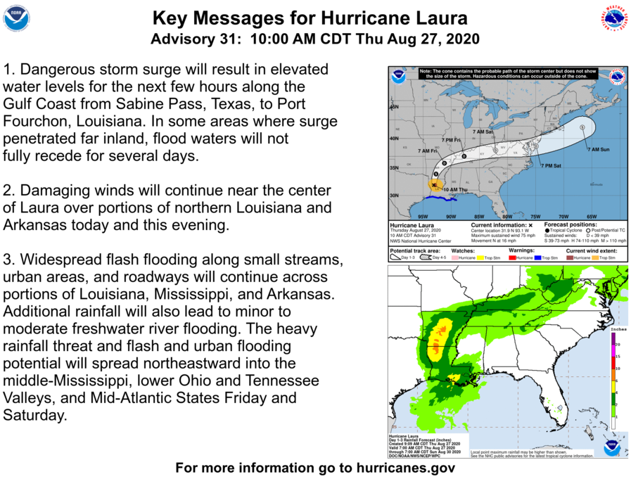
In our area, a Storm Surge Warning is in effect for Sabine Pass, Texas to Port Fourchon, Louisiana. A Tropical Storm Warning is in effect for High Island, Texas to the Mouth of the Mississippi River.
Water levels remain elevated along the Gulf Coast and will continue to subside over the next few hours. Tornadoes are possible through tonight over parts of Louisiana, Arkansas, and western Mississippi.

This will likely be our last update on Hurricane Laura as she moves swiftly our of the Terrebonne/Lafourche area.
At 10 a.m. CDT, the center of Hurricane Laura was located inland about 55 miles (85 km) southeast of Shreveport, La. It’s moving toward the north near 16 mph (26 km/h) and this motion should continue through today. A northeastward to east-northeastward motion is expected tonight and Friday. On the forecast track, Laura will move northward across northern Louisiana this afternoon. The center of Laura is forecast to move over Arkansas tonight, the mid-Mississippi Valley on Friday, and the mid-Atlantic states on Saturday.
Maximum sustained winds are near 75 mph (120 km/h) with higher gusts. Hurricane-force winds extend outward up to 35 miles (55 km) from the center and tropical-storm-force winds extend outward up to 105 miles (165 km). Rapid weakening is forecast, and Laura is expected to become a tropical storm withing the next few hours, and weaken to a tropical depression tonight.

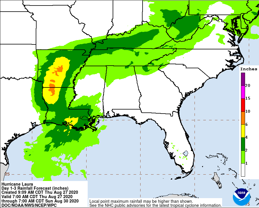
Through Friday, Laura is expected to produce additional rainfall totals of 4 to 8 inches across portions of Louisiana, Mississippi and Arkansas, with isolated storm totals of 18 inches over Louisiana. This rainfall will continue to cause widespread flash and urban flooding, small streams and creeks to overflow their banks, and minor to moderate freshwater river flooding. Through Saturday, Laura is expected to produce 1 to 3 inches with isolated maximum amounts of 5 inches across the mid-Mississippi Valley, portions of the Tennessee and Lower Ohio Valleys, the central Appalachians, and the Mid-Atlantic States. This rainfall may lead to flash and urban flooding and rapid rises on small streams.
The next complete advisory will be issued by NHC at 4 p.m. CDT with an intermediate advisory at 1 p.m. CDT

