
Nicholls Athletics introduces Locker Naming Project
December 23, 2020
Presumed recovered reaches 247,501 statewide
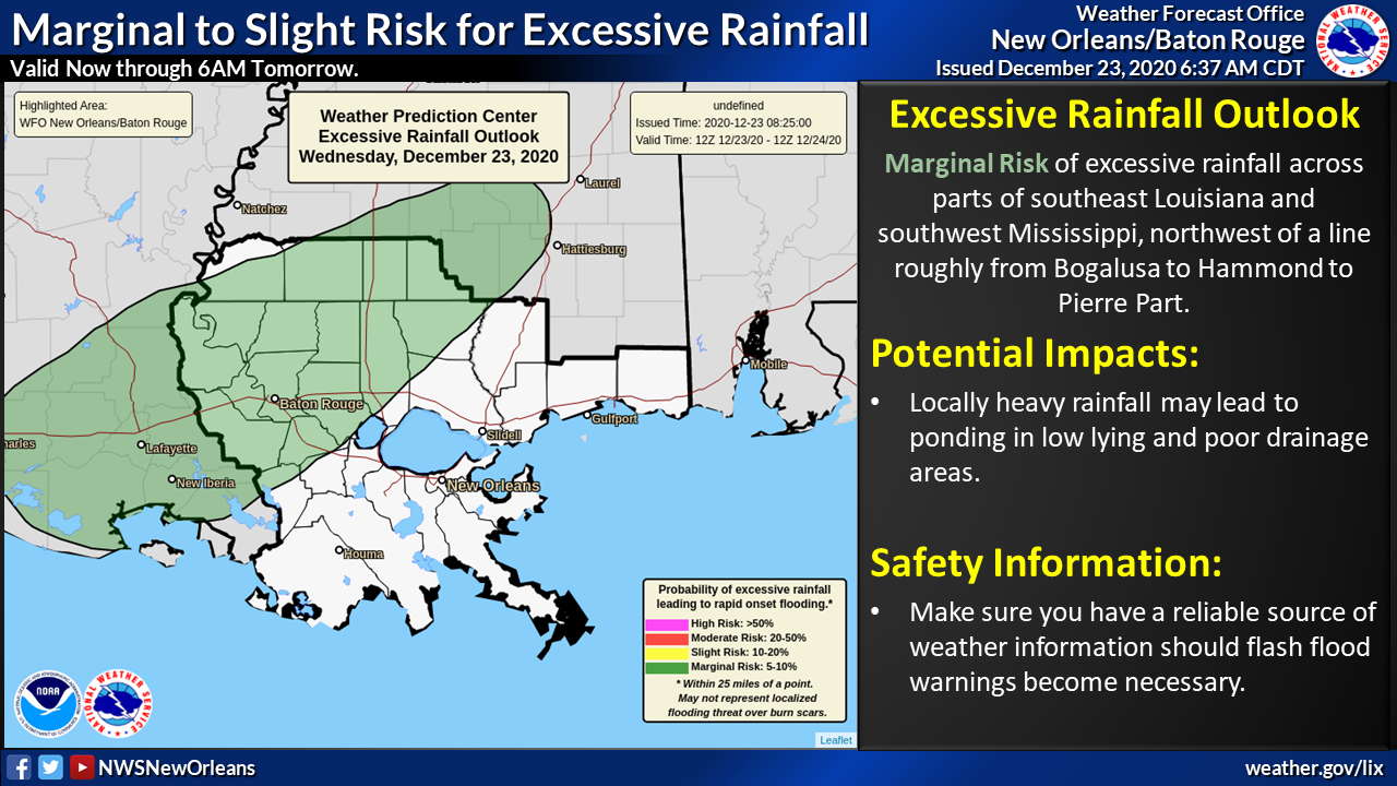
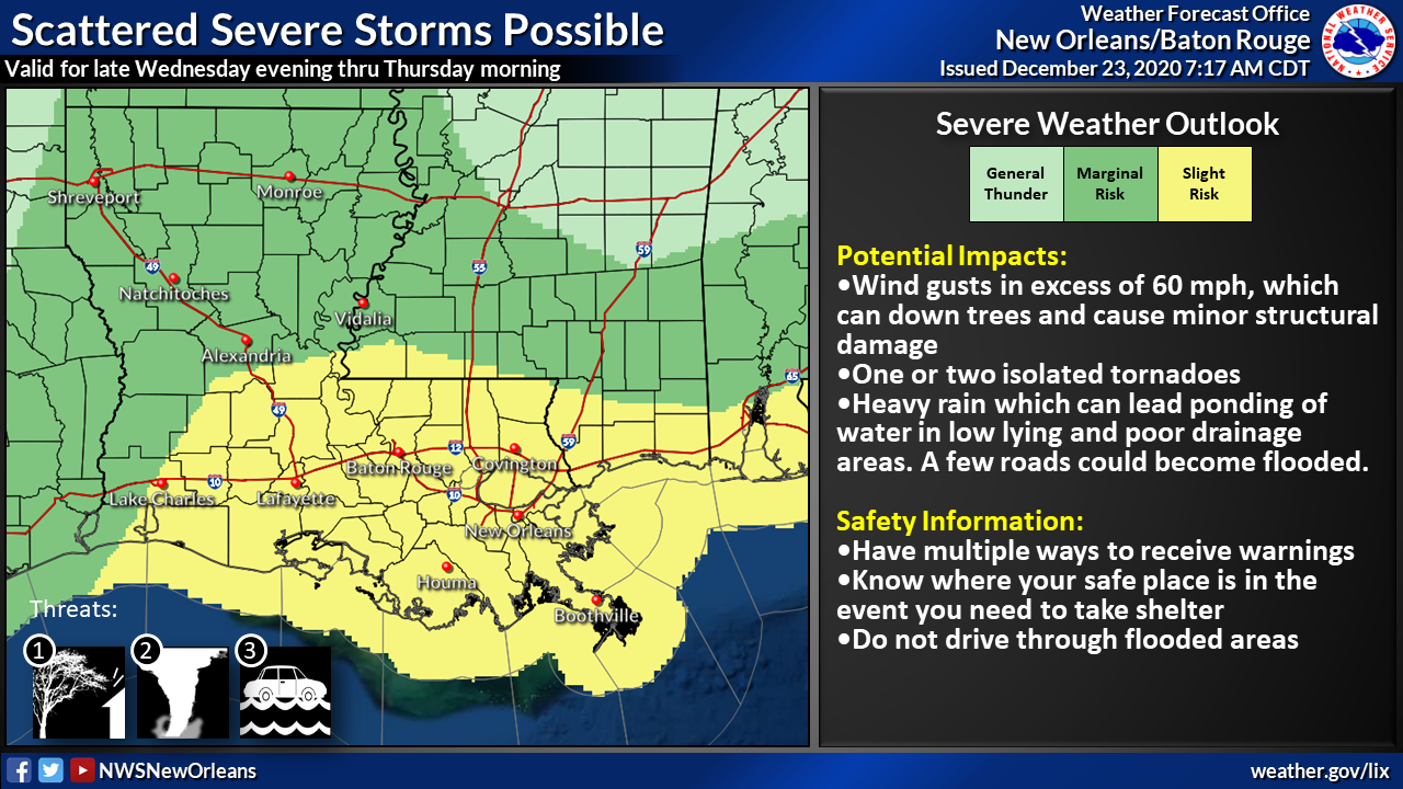
December 23, 2020There is a slight risk of severe for all of southeast Louisiana from tonight into Thursday morning, according to the National Weather Service New Orleans.
Changes from previous update:
-
Marginal risk of severe weather has been upgraded to slight for all of southeast LA and southern Mississippi.
-
There is now a marginal risk of excessive rainfall for portions of southeast LA and southwest Mississippi.
Overview:
WHAT: SLIGHT RISK of Severe Weather
MARGINAL RISK of Heavy Rain
WHEN: Tonight into Thursday morning
WHERE: For severe weather, southeast Louisiana and southern Mississippi.
For heavy rainfall, areas northwest of a line roughly from Bogalusa to Hammond to Pierre Part.
CONFIDENCE:
-
We are confident there will be some thunderstorms across the area. We have less confidence that these storms will result in severe weather or heavy rainfall.
Impacts:
The main threats associated with any severe storms will be:
Damaging Winds:
-
Wind gusts greater than 60 mph will be possible.
Tornadoes:
-
An isolated tornado is possible.
Rainfall:
-
In addition to the severe weather threat, rainfall of 1 to 2 inches is forecast with locally higher amounts possible.
-
This rainfall could lead to ponding of water in low lying areas and areas of poor drainage.
The graphics below highlights the threats associated with this system.
